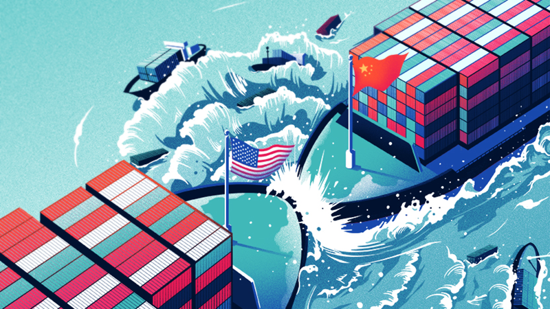
Mỹ nâng Tariff – Lợi & Hại?
By Le Hoang
/ 9. July 2025
Từ thời Trump đến Biden, rồi quay lại Trump, xu hướng nâng thuế nhập khẩu, đặc biệt với Trung Quốc...
Read More


![]()
Views: 0

The ministers shared the view that after 25 years of development, the ARF has continued to affirm its role as one of the key forums for dialogue and cooperation in politics-security, building trust, and implementing preventive diplomacy in the region.
The ministers welcomed the recent progress in regional issues and called on relevant parties to fully and seriously implement the reached agreements to ensure sustainable peace and stability on the Korean Peninsula.
The ministers also voiced concerns about trade protectionism and emerging security challenges, including terrorism, trans-national crimes, marine security, cybersecurity, and natural disasters. They agreed to strengthen cooperation within the framework of the ARF and other regional mechanisms to better cope with these challenges.
Regarding the East Sea issue, the ministers reaffirmed the significance of maintaining and promoting peace, security, stability, and freedom of navigation and aviation in the East Sea. Many of them voiced concerns over activities which have eroded trust, including militarization, increased tension and may undermine peace, security, and stability in the region. Thus, the ministers laid stress on the restraint and settlement of disputes based on international laws and the United Nations Convention on the Law of the Sea 1982 (UNCLOS) as well as respect of the diplomatic progress and legal procedures. They said that concerned parties must not use or threaten to use force, and not carry out militarization activities, while fully and effectively implementing the Declaration on the Conduct of Parties in the East Sea (DOC), towards reaching an effective Code of Conduct in the East Sea.
At the forum, the ministers agreed to adopt the ARF statement on disaster relief cooperation, the list of the ARF’s activities in 2018 and 2019, and the ARF’s work plans on maritime security and disaster relief in 2018-2020.
In his address, Deputy Prime Minister Phạm Bình Minh lauded the ARF’s role and contributions in the past time, including the promotion of dialogues, and cooperation to build trust and respond to security challenges. Hệ informed Vietnam’s initiatives to host an ARF workshop on enhancing cooperation among law enforcement forces at sea, and another seminar on applying the 1982 UN Convention on the Law of the Sea and international legal tools to cope with marine challenges./.
![]()
Views: 0
Hiệp hội các quốc gia Đông Nam Á (ASEAN) và Trung Quốc đã đạt được thỏa thuận một “văn bản duy nhất” đàm phán về Bộ Quy tắc ứng xử ở Biển Đông (COC), một bước tiến quan trọng hướng tới việc thu hẹp sự khác biệt giữa các bên.
Phát biểu tại Hội nghị Bộ trưởng ASEAN-Trung Quốc bên lề Hội nghị Bộ trưởng Ngoại giao ASEAN lần thứ 51 (AMM 51) diễn ra tại Singapore ngày 2/8, Ngoại trưởng Singapore Vivian Balakrishnan tuyên bố đây là “cột mốc quan trọng” trong tiến trình COC, kể từ Hội nghị các quan chức cấp cao ASEAN-Trung Quốc về thực thi Tuyên bố ứng cử của các bên ở Biển Đông (DOC) diễn ra tại Trung Quốc vào tháng 6/2018.

Cũng theo Ngoại trưởng Vivian Balakrishnan, đây sẽ là văn bản cơ sở cho các cuộc đàm phán COC trong tương lai và hai bên cũng đã thống nhất các phương thức chính cho các cuộc đàm phán COC trong thời gian tới.
Singapore là nước điều phối viên cho quan hệ đối thoại ASEAN-Trung Quốc từ năm 2015-2018 và sẽ chính thức bàn giao trọng trách này cho Philippines sau hội nghị lần này.
Tiến trình đàm phán COC đã diễn ra trong hơn một thập kỷ qua, với nhiều khó khăn về các điều khoản cũng như tốc độ của các cuộc đàm phán.
Tuy nhiên, trong những năm gần đây đã có những dấu hiệu rõ ràng về sự thống nhất quan điểm của ASEAN về vấn đề Biển Đông.
Tháng Tám năm ngoái, các Bộ trưởng Ngoại giao Trung Quốc và ASEAN đã thông qua dự thảo khung đàm phán cho COC, một động thái được coi là tiến bộ trong quá trình giải quyết căng thẳng trên Biển Đông.
Tháng Ba năm nay, một nhóm làm việc chung đã được tổ chức để thực hiện Tuyên bố về ứng xử của các bên ở Biển Đông.
Thủ tướng Singapore Lý Hiển Long trong tuyên bố hồi tháng 4/2018 cho rằng các cuộc đàm phán tháng về COC sẽ không dễ dàng, nhưng ông nhấn mạnh rằng các nước tham gia vào các cuộc đàm phán cần mang tính xây dựng nhằm ngăn chặn những căng thẳng leo thang.
Ngoại trưởng Vivian Balakrishnan cho biết Trung Quốc là một trong những đối tác đối thoại trọng tâm của ASEAN và cả hai bên đã đạt được nhiều kết quả trong ba năm qua, với sự hợp tác củng cố bởi các mối liên hệ kinh tế mạnh mẽ.
Tuy nhiên, ông cũng nhấn mạnh rằng quán trình hợp tác giữa các bên chỉ có thể dựa trên nền tảng của sự tin tưởng lẫn nhau, cùng giải quyết các khác biệt một cách hòa bình và theo tinh thần thiện chí./.
Vietnam+
![]()
Views: 0
So với khoảng thời gian này năm ngoái, tình hình thế giới trong nửa đầu năm nay đã có nhiều biến động bất ngờ. Bức tranh về tình hình thế giới luôn pha trộn nhiều gam màu khác nhau và vị trí các gam màu đó đến nay đã có sự chuyển dịch rõ rệt. Nửa năm là khoảng thời gian ngắn đến mức chưa đủ để nhìn vào động thái nhận ra được xu hướng diễn biến của tình hình. Dù vậy, nhìn lại thế giới trong nửa năm qua vẫn có thể rút ra một số kết luận và đưa ra một số dự báo nhất định cho nửa năm còn lại.
Trước hết, việc khởi động tiến trình hòa giải giữa Triều Tiên và Hàn Quốc cũng như giữa Triều Tiên và Mỹ là đột biến lớn với ý nghĩa và tác động rất mạnh mẽ và sâu sắc tới cả thế giới trong nửa năm qua. Đỉnh cao cho tới nay của tiến trình này là cuộc gặp thượng đỉnh liên Triều lần thứ 3 diễn ra ngày 27/4 tại Bàn Môn Điếm và cuộc gặp cấp cao đầu tiên trong lịch sử giữa Mỹ và Triều Tiên tại Singapore ngày 12/6 vừa qua dù cho tới tận cuối năm ngoái, tiến trình này vẫn còn là chuyện không tưởng. Sự khởi đầu rất suôn sẻ và ngoạn mục nhưng tiếp theo đó không đơn giản bởi sẽ phụ thuộc vào việc Mỹ, Hàn Quốc và Triều Tiên có thực hiện đầy đủ và nghiêm chỉnh những cam kết và thỏa thuận với nhau hay không và có tiếp được đà hòa dịu hiện có hay không? Bộ ba này đã đạt được sự hiểu biết chung về giải quyết những vấn đề đang đặt ra như phi hạt nhân hóa bán đảo Triều Tiên, bảo đảm an ninh cho Triều Tiên, chấm dứt tình trạng chiến tranh và nguy cơ xung đột, bình thường hóa quan hệ song phương… Thực tiễn nửa năm còn lại sẽ cho thấy các bên liên quan có thật sự cùng nhau giải quyết những vấn đề đấy hay không. Tiến trình này hiện chưa ổn định và bền vững đến mức không còn có thể bị đảo ngược. Dù vậy, nó đã giúp khu vực Đông Bắc Á trong thời gian vừa qua “hòa bình” hiếm thấy từ trước tới nay và khơi dậy hy vọng cũng như lạc quan về thời kỳ tới tốt đẹp.
Đột biến thứ hai là việc Tổng thống Mỹ Donald Trump đã “kích hoạt” cuộc xung đột thương mại với nhiều đối tác kinh tế và thương mại lớn của Mỹ. Ông Trump sử dụng những biện pháp bảo hộ thương mại để “khiêu chiến” với cả những đối tác thương mại quan trọng nhất của Mỹ là EU, Trung Quốc, Canada, Mexico, Nhật Bản… trong nhận thức rõ ràng ngay từ đầu là những biện pháp ấy trái với cam kết và trách nhiệm của Mỹ trong Tổ chức thương mại thế giới (WTO) và nước Mỹ sẽ bị các đối tác kia đáp trả thích đáng. Đằng sau cuộc chiến thương mại này giữa Mỹ và các đối tác còn có cuộc phân định “ai sẽ thắng ai” giữa mậu dịch tự do và bảo hộ mậu dịch trên thế giới, còn có cuộc tấn công vào trật tự thương mại thế giới tự do, vào vai trò của WTO và vào cục diện các mối quan hệ quốc tế trong thế giới hiện đại. Các nước trên thế giới buộc phải xem xét lại chính sách kinh tế, thương mại của họ nói chung và phải xử lý lại quan hệ của họ với Mỹ nói riêng để bảo toàn tốt nhất lợi ích trước mắt cũng như lâu dài. Chính trị an ninh thế giới vì thế cũng bị ảnh hưởng.

Khu vực Đông Bắc Á chuyển biến tích cực và đáng khích lệ bao nhiêu thì diễn biến tình hình chính trị an ninh ở khu vực Trung Đông, Bắc Phi và vùng Vịnh vẫn căng thẳng và bạo lực đáng lo ngại bấy nhiêu. Tổ chức Nhà nước Hồi giáo tự xưng IS đã chính thức bị đánh bại, nhưng chiến sự vẫn diễn ra ở Syria, Iraq và Yemen. Ở Syria, chính phủ của Tổng thống Bashar Al-Assad đã thắng thế những cuộc chiến vẫn chưa chấm dứt và tiến trình hòa bình hướng tới giải pháp chính trị vẫn còn xa vời và trắc trở. Cả việc Tổng thống Mỹ D.Trump công nhận Jerusalem là thủ đô của Israel và chuyển đại sứ quán Mỹ từ Tel Aviv về Jerusalem lẫn việc Mỹ rút khỏi thỏa thuận về giải pháp cho vấn đề hạt nhân của Iran đều làm cho tình hình chính trị an ninh ở khu vực càng thêm tồi tệ, quan hệ giữa các bên đối địch nhau càng thêm căng thẳng. Cuộc chiến tranh của Saudi Arabia và liên quân ở Yemen cùng với cuộc chiến ngoại giao của nước này và một số đồng minh chống Qatar làm cho cả khu vực này thêm trầm trọng và phức tạp về an ninh. Quan hệ giữa Mỹ, Trung Quốc, và Nga biến động theo những chiều hướng khác nhau. Ở cả ba nước lớn này, vị thế quyền lực của người đang nắm thực quyền được củng cố vững chắc, giúp họ có thể tự tin hơn và quyết liệt hơn trong cầm quyền và xử lý quan hệ với nhau ở thời gian tới.
Giữa Nga và Trung Quốc, đà phát triển quan hệ song phương được duy trì. Giữa Mỹ với hai nước này, quan hệ đã trở nên khác trước. Ông Trump đã làm cho quan hệ của Mỹ với Trung Quốc “găng” hơn so với ở thời trước trong khi quan hệ của Mỹ với Nga bắt đầu có cơ hội không còn xấu như trước. Bằng chứng là ông Trump phát động cuộc xung đột thương mại quyết liệt với Trung Quốc trong khi kiên định gây dựng lại sự khởi đầu mới quan hệ Mỹ – Nga, đỉnh cao là cuộc gặp đầu tiên giữa nhà lãnh đạo hai nước này tuần qua. Hai trục quan hệ Mỹ – Nga và Mỹ – Trung đặc biệt nổi trội trong thời gian vừa qua trên phương diện tác động mạnh mẽ tới diễn biến tình hình thế giới.
Ở khu vực nào và châu lục nào cũng đều có nhiều biến động, nhưng đều ở bình diện quốc gia chứ không có được tác động làm rung chuyển cả khu vực hay châu lục. Venezuela ở khu vực Mỹ Latinh, Nam Phi ở châu Phi, Malaysia ở châu Á, EU ở châu Âu… đều có những dốc mốc lịch sử mới và đồng thời đều cho thấy chuyện quyền lực và chính trị xã hội nội bộ ở các quốc gia có thể biến động nhanh chóng và khó lường như thế nào.
Nhìn nhận một cách toàn diện thì có thể đi tới đánh giá rằng thế giới trong nửa năm qua cho dù có đột biển nhưng về cơ bản vẫn tiếp tục chiều hướng biến động từ thời gian trước, chưa phải đã chuyển giai đoạn và chưa bước sang một thời kì mới. Khủng bố vẫn diễn ra ở nhiều nơi. Mất an ninh và ổn định ở nhiều vùng vẫn dai dẳng. Nhưng thế giới không bị xáo động bởi khủng bố, chiến tranh và xung đột vũ trang.
Một gam màu sáng sủa trong bức tranh về tình hình thế giới thời gian vừa qua là kinh tế thế giới và các khu vực về cơ bản tiếp tục đà tăng trưởng với mức độ chưa thật cao nhưng tính ổn định đã khá hơn. Bất chấp giá dầu lửa tăng, bất chấp xung đột thương mại và chính sách tiền tệ của các ngân hàng trung ước quốc gia đối với những đồng tiền quan trọng nhất trên thế giới đã bắt đầu được xiết chặt lại. Cả trên những phương diện này hiện cũng có lý do xác đáng và cơ sở thực tế để lạc quan cho thời gian tới./.
Ngư Phủ
![]()
Views: 0
![]()
Views: 0
Viet Nam’s historical sovereignty over Hoang Sa and Truong Sa archipelagoes
In the old days, with vague information about Hoang Sa and Truong Sa archipelagoes, navigators only knew about a large area in the middle of the sea with submerged cays, which was very dangerous for watercrafts, referred to as “Bien Dong” (East Sea) by the Vietnamese. Vietnamese ancient documents indicate this area with various names, including “Bai Cat Vang” (Golden Sandbank), “Hoang Sa” (Golden Sand), “Van Ly Hoang Sa” (Ten-thousand-Li1 Golden Sand), “Dai Truong Sa” (Grand Long Sand), or “Van Ly Truong Sa” (Ten-Thousand-Li Long Sand).
Most of the nautical maps made by western navigators from the 16th to the 18th centuries depict Hoang Sa and Truong Sa archipelagoes as a single archipelago and name it “Pracel”, “Parcel”, or “Paracels”2. Later progress in science and navigation allowed the differentiation between the two archipelagoes. It was not until 1787-1788 that Hoang Sa and Truong Sa archipelagoes were located clearly and accurately as they are known today by the Kergariou – Locmaria survey mission to help distinguish Hoang Sa archipelago from Truong Sa archipelago in the South. All of the abovementioned maps define Pracel (including both Hoang Sa and Truong Sa archipelagoes) as an area in the middle of the East Sea, to the east of mainland Viet Nam and located further offshore compared to Viet Nam’s coastal islands.
The two archipelagoes indicated as the “Paracels” and the “Spratley” or “Spratly” islands in current international nautical maps are indeed those that are Viet Nam’s Hoang Sa and Truong Sa archipelagoes.
The Vietnamese people have long discovered Hoang Sa and Truong Sa archipelagoes, and Viet Nam has exercised its sovereignty over the two archipelagoes in a continuous and peaceful manner.
Toan Tap Thien Nam Tu Chi Lo Do Thu (Route Maps from the Capital to the Four Directions), compiled in the 17th century by a man named Do Ba, clearly noted in the maps of Quang Ngai prefecture in Quang Nam area that “In the middle of the sea is a long sandbank, called Bai Cat Vang, with a length of 400 li and a width of 20 li, spanning in the middle of the sea from Dai Chiem to Sa Vinh Seaports3. Foreign ships would be drifted and stranded on the bank if they traveled on the inner side (west) of the sandbank under the southwest wind or on the outer side under the northeast wind (east). Their sailors would starve to death and leave all their goods there”.
In the book entitled Giap Ngo Binh Nam Do (The Map for the Pacification of the South in the Giap Ngo year) made by duke Bui The Dat in 1774, Bai Cat Vang is also indicated as a part of Viet Nam’s territory4.

A 16th- century Portuguese nautical map depicting Hoang Sa and Truong Sa archipelagoes as a single archipelago located to the east of Viet Nam’s mainland.
During his assignment in South Viet Nam, scholar Le Quy Don (1726-1784) in 1776 compiled the book named Phu Bien Tap Luc (Miscellaneous Records on the Pacification at the Frontier) on the history, geography, and administration of South Viet Nam under the Nguyen lords (1558-1775), In this book, Le Quy Don described that Dai Truong Sa, including Hoang Sa and Truong Sa archipelagoes, was under the jurisdiction of Quang Ngai prefecture.

A page of “Toan Tap Thien Nam Tu Chi Lo Do Thu”
“An Vinh commune, Binh Son district, Quang Ngai prefecture has a mountain5 outside its seaport called Re island, which is 30-li wide. It takes four watches to reach the island, on which there is a ward named Tu Chinh with bean-growing inhabitants. Further offshore is the Dai Truong Son island, where there are plenty of sea products and other goods. It takes Hoang Sa Flotilla, founded to collect those products and goods, three full days to reach the island, which is near Bac Hai.”
“… Binh Son district of Quang Ngai prefecture includes the coastal commune of An Vinh. Offshore to the northeast of An Vinh are many islands and approximately 130 mountains separated by waters which can take from few watches to few days to travel across. Streams of fresh water can be found on these mountains. Within the islands is a 30-li long, flat and wide golden sand bank, on which the water is so transparent that one can see through. The islands have many swift nests and hundreds or thousands of other kinds of birds; they alight around instead of avoiding humans. There are many curios on the sandbank. Among the volutes are the Indian volutes. An Indian volute here can be as big as a mat; on their ventral side are opaque beads, different from pearls, and as big as fingertips; their shells can be carved to make identification badges or calcinated to provide lime for house construction. There are also conches that can be used for furniture inlay, and Babylon shells. All snails here can be salted for food. The sea turtles are oversized. There is a softy-shell sea turtle called “hai ba” or “trang bong”, similar to but smaller than the normal hawksbill sea turtles; their thin shell can be used for furniture inlay, and their thumb-sized eggs can be salted for food. There is a kind of sea cucumbers called “dot dot”, normally seen when swimming about the shore; they can be used as food after lime treatment, gut removal and drying. Before serving “dot dot”, one should process it with crab-extracted water and scrape all the dirt off. It will be better if cooked with shrimps and pork.
Foreign boats often take refuse at these islands to avoid storms. The Nguyen rules have established Hoang Sa Flotilla with 70 sailors selected from An Vinh commune on a rotational basis. Selected sailors receive their order in the third month of every year, bring with them sufficient food for six months, and sail on five small fishing boasts for full days to reach the islands. Once settled down on the islands, they are free to catch as many birds and fish as they like. They collect goods from boats passing by, such as sabers, jewelries, money, porcelain rings, and fur; they also collect plenty of sea turtle shells, sea cucumbers, and volute shells. The sailors return to mainland in the eighth month through EO seaport. On their return trip, they first sail to Phu Xuan Citadel, where the goods that they have collected shall be submitted to be measured and classified; they can then take their parts of volutes, sea turtles, and sea cucumbers for their own trading businesses, and receive licenses before going home. The amount of collected materials varies; sometimes the sailors could not collect anything at all. I have personally checked the notebook of the former flotilla captain Thuyen Duc Hau, which recorded the amount of collected goods: 30 scoops of silver in the year of Nham Ngo (1762), 5,100 catties of tin in the year of Giap Than (1764), 126 scoops of silver in the year of At Dan (1765), a few sea turtle shells each year from the year of Ky Suu (1769) to the year of Quy Ty (1773). There were also years when only cubic tin, porcelain bowls, and two copper guns were collected.
The Nguyen rulers also established Bac Hai Flotilla without a fixed number of sailors, selected from Tu Chinh village in Binh Thuan or from Canh Duong commune. Sailors are selected on a voluntary basis. Those who volunteer to join the flotilla will be exempted from poll tax, patrol and transportation fees. These sailors travel in small fishing boats to Bac Hai, Con Lon island, and other islands in Ha Tien area, collecting goods from ships, and sea products such as turtles, abalones, and sea cucumbers. Bac Hai Flotilla is under command of Hoang Sa Flotilla. The collected items are mostly sea products and rarely include jewelries.”
Among those documents that have been preserved until today is the following order dated 1786 made by Lord Superior:
“Hereby command Hoi Duc Hau, captain of Hoang Sa Flotilla, to lead four fishing boats to sail directly towards Hoang Sa and other islands on the sea, to collect jewelries, copper items, cannons of all sizes, sea turtles, and valuable fishes, and to return to the capital to submit all of these items in accordance with the current regulation”.

An Nam Dai Quoc Hoa Do

Dai Nam6 Nhat Thong Toan Do (The Complete Map of the unified Dai Nam – the map of Viet Nam under the Nguyen Dynasty in 1883) indicated that “Hoang Sa” and “Van Ly Truong Sa” are Vietnamese territories. These archipelagoes were depicted to be further offshore compared to those near the central coast.
Dai Nam Nhat Thong Chi (The Geography of the Unified dai Nam), the geography book completed in 1882 by the National History Institute of The Nguyen Dynasty (1802-1845), indicates that Hoang Sa archipelago is part of Viet Nam’s territory and was under the administration of Quang Ngai province.
In the paragraphs describing the topography of Quang Ngai province, the book wrote:
“In the east of Quang Ngai province is Hoang Sa island, in which sands and waters are alternate, forming trenches. In the west is the area of mountainous people with the steady and long rampart. The south borders Binh Dinh province, separated by the Ben Da mountain pass.
The north borders Quang Nam province, marked by the Sa THo Creek…”
“… The previous custom of maintaining Hoang Sa Flotilla was continued in the early days of the Gia Long Era but later abandoned. At the beginning of the Minh Mang Era, working boats were sent to the area for sea route survey. They found an area with verdant plants over white sands and a circumference of 1,070 truong7. In the middle of Hoang Sa island is a well. In the southwest lies an ancient temple with no clear indication of the construction time. Inside the temple is a stele engraved with four characters “Van Ly Ba Binh”8. This island had previously been called “Phat Tu Son”9. In the east and the west of the island is an atoll named Ban Than Thach (coral reef). It emerges over the water level as an isle with a circumference of 340 truong and a height of 1.2 truong. In the 16th year of the Minh Mang Era, working boats were ordered to transport bricks and stones to the area to build temple. In the left side of the temple, a stone stele was erected as a remark, and trees are planted all over three sides, namely the left, the right, and the back, of the temple. While building the temple’s foundation, the military laborers found as much as 2,000 catties of copper leaves and cast iron.”
Many Western navigators and Christian missionaries in the past centuries attested that Hoang Sa (Pracel or Paracels) belongs to Viet Nam’s territory.
A Western clergyman wrote in a letter during his 1701 trip on the ship Amphitrite from France to China that: “Paracel is an archipelago of the Kingdom of An Nam”10.
Bishop J.L. Taberd, in his 1837 “Note on the Geography of Cochinchina”11, also describes “Pracel or Paracels” as a part of Cochinchina’s territory and indicates that Cochinchinese people refer to Paracles as “Cat Vang”. In An Nam Dai Quoc Do (Tabula geographica imperii Anamitici – The Map of the An Nam Empire)12 published in 1883, Bishop Taberd depicted part of Paracels and noted “paracel seu Cat Vang” (Paracel or Cat Vang) for the archipelago farther than those near the shore of central Viet Nam, corresponding to the area of Hoang Sa archipelago nowadays.
J.B Chaineau, one of the counselors to Emperor Gia Long, wrote in the 1820 complementary note to his “Mémoire sur Cochinchine” (Memoir on Cochinchina)13 that: “The Country of Cochinchina, whose emperor has just ascended to the throne, includes the Regions of Cochinchina and Tonkin14 … some inhabited islands not too far from the shore, and the Paracel archipelago composed of uninhabited small islands, creeks, and cays.”
In the article “Geography of the Cochinchinese Empire”15, written by Gutzlaff and published in 1849, some parts clearly indicate that Hoang Sa is part of Viet Nam’s territory and even noted the archipelago with the Vietnamese name “Cat Vang”./.
![]()
Views: 0

“We need to pay more attention to FDI projects by countries with modern industry. In particular, we need to prioritize projects with technology level of industry 4.0. This is an opportunity for us to improve the capacity and competitiveness of our economy,” Thang said./.
![]()
Views: 0
Từ cơ sở hạ tầng
Khoảng 5 năm qua, nhiều tổ chức nghiên cứu quốc tế cũng như chính phủ các nước đã cung cấp không ít hình ảnh về việc Trung Quốc lắp đặt các hệ thống radar, thiết bị do thám, gây nhiễu…; kèm theo đó là hàng loạt cơ sở được hoàn thiện như đường băng, nhà chứa máy bay tại các thực thể mà Trung Quốc chiếm đống trái phép ở hai quân đảo Hoàng Sa và Trường Sa thuộc chủ quyền Việt Nam.
Năm 2017, Chương trình sáng kiến minh bạch hàng hải châu Á (AMTI) thuộc Trung tâm nghiên cứu chiến lược quốc tế Mỹ (CSIS) đã công bố đánh giá toàn cảnh Trường Sa năm 2016, tiết lộ, Bắc Kinh hoàn thiện trên cả 3 đường băng ở bãi đá Xu Bi, Vành Khăn và Chữ Thập. Trước đó, hồi đầu tháng 8/2016, AMTI công bố hình ảnh cho thấy các nhà chứa máy bay được gia cố trên Chữ Thập, đá Xu Bi và đá Vành Khăn ở Trường Sa. Từ quá trình phân tích hình ảnh, giới chuyên gia của CSIS nhận xét, các nhà chứa máy bay ở 3 bãi đá trên đủ sức chứa máy bay ném bóm H-6, máy bay tiếp liệu H-6U, máy bay vận tải Y-8 và máy bay KJ-200 chuyên trinh sát cảnh báo sớm. Bên cạnh đó, hạ tầng được hoàn thiện có thể cho phép đồn trú hàng chục chiến đấu cơ Su-30 hoặc J-11.

Đến mạng lưới không quân
Song hành cùng việc phát triển hạ tầng, Bắc Kinh cũng điều động chiến đấu cơ đến các khu vực trên. Tháng 5/2016, Bộ Quốc phòng Mỹ công bố báo cáo “Các diễn tập quân sự và an ninh liên quan Trung Quốc 2016”. Theo báo cáo này, từ tháng 2/2016, các hình ảnh vệ tình chỉ ra rằng chiến đấu cơ J-11 đã được triển khai trên đảo Phú Lâm thuộc quần đảo Hoàng Sa của Việt Nam (nhưng bị Trung Quốc chiếm đóng trái phép). Dòng máy bay J-11 với bán kính tác chiến khoảng 1.500km, trang bị nhiều loại bom và tên lửa, đặc biệt là tên lửa đối không. Nhờ đó, J-11 có thể hoạt động khắp vùng trời Biển Đông, kéo dài từ vịnh Bắc Bộ đến quần đảo Trường Sa của Việt Nam. Và thực tế, vào tháng 5/2016, theo các nguồn tin quân sự tiết lộ, J-11 của Trung Quốc đã “vờn” máy bay trinh sát của Mỹ ở khu vực này.
Không chỉ J-11, gần đây, dòng máy bay tiêm kích J-10 cũng đã có mặt tại đảo Phú Lâm và cả các thực thể thuộc quần đảo Trường Sa. J-10 là loại chiến đấu cơ đa nhiệm thế hệ 4 có tốc độ tối đa Mach 2,2 (hơn 2500km/h), bán kính chiến đấu khoảng 550km và có thể xa hơn khi được hỗ trợ bằng máy bay tiếp nhiên liệu trên không. J-10 được trang bị các loại súng tự động, kèm theo tên lửa đối không, bom dẫn đường bằng tia laser, tên lửa tấn công mặt đất và tấn công tàu chiến…
Bên cạnh 2 dòng máy bay tiêm kích trên, các hình ảnh do AMTI công bố từ năm 2016 còn chỉ ra Bắc Kinh điều động cả oanh tạc cơ JH-7 đến Phú Lâm. Đây là loại máy bay có bán kính chiến đấu lên đến hơn 1.700km, tích hợp nhiều loại tên lửa đối không và đối hải.
Đến giữa tháng 5/2018, thông qua tài khoản twitter, tờ Nhân dân nhật báo của Trung Quốc tung ra đoạn phim chứa cảnh oanh tạc cơ H-6K diễn tập cất và hạ cánh xuống một đường băng trên Biển Đông. Sau đó, hoạt động này được xác định là diễn ra tại đảo Phú Lâm. Không chỉ có thể mang theo các loại tên lửa đối đất, H-6K còn được trang bị các loại tên lửa tấn công tàu chiến. Qua đó, với việc kết hợp các loại chiến đấu cơ trên, Bắc Kinh gần như thử nghiệm thành công để có thể triển khai toàn diện lực lượng không quân đủ sức tác chiến không – hải và tấn công các thực thể trên Biển Đông. Truyền thông Trung Quốc cũng từng đăng tải hình ảnh hoạt động của một số loại máy bay quân sự, máy bay vận tải Y7 và Y8 đóng vai trò hỗ trợ. Điều này cho thấy, Bắc Kinh có thể vận hành một mạng lưới không quân toàn diện.

Và thế trận không – hải
Bên cạnh việc tăng cường tác chiến không quân, Trung Quốc cũng lắp đặt hệ thống tên lửa trên các thực thể ở cả hai quần đảo Trường Sa và Hoàng Sa. Việc triển khai này khá tương thích với chiến lược Phong tỏa/Chống tiếp cận (A2/AD) mà Bắc Kinh phát triển trong nhiều năm qua.
Ở Hoàng Sa, các hình ảnh do AMTI công bố vào tháng 2/2016 xác định, Bắc Kinh đã triển khai hệ thống tên lửa đối không HQ-9 trên đảo Phú Lâm. Được xem là “S-300 phiên bản Trung Quốc”, HQ-9 có tầm bắn khoảng 250km với tốc độ tối đa gấp 4 lần vận tốc âm thanh, cho phép theo dõi và tấn công cùng lúc nhiều mục tiêu. Cho nên, việc lắp đặt HQ-9 là một biện pháp nhằm thiết lập lưới phòng không cho các đảo mà Bắc Kinh chiếm đóng phi pháp trên Biển Đông. Đến tháng 3/2016, kênh truyền hình Phượng Hoàng của Hồng Kong đăng tải hình ảnh cho thấy Trung Quốc nhiều khả năng cũng đã triển khai tên lửa hành trình chống hạm YJ-62 trên đảo Phú Lâm. Với ưu thế trần bay khá thấp, YJ62 có phiên bản đạt tầm bắn lên đến 400km. Vì thế, YJ-62 kết hợp cùng HQ-9 tạo điều kiện để Bắc Kinh hình thành hệ thống tên lửa “không-hải” theo chiến lược A2/AD.
Tại quần đảo Trường Sa, vào đầu tháng 5/2018, kênh CNBC (Mỹ) dẫn một số nguồn tin tiết lộ trong 30 ngày trước đó, Trung Quốc đã âm thầm điều tên lửa hành trình chống hạm YJ-12B và hệ thống tên lửa đối không HQ-9B đến 3 bãi đá Chữ Thập, Vành Khăn và Xu Bi. Một số hình ảnh khác hồi năm ngoái còn cho thấy, hạ tầng trên các thực thể mà Bắc Kinh chiếm giữ trái phép ở Trường Sa cũng có dấu hiệu được dùng để thiết lập cả tên lửa HHQ-9. Cả HQ-9B và HHQ-9 đều là các phiên bản của HQ-9. Trong đó, HHQ-9 là phiên bản thường được thiết kế dành cho tàu chiến. Còn YJ-12B đạt tốc độ nhanh gần gấp 3 lần vận tốc âm thanh cùng tầm bắn có thể lên đến 400km. Như vậy, một mô hình mạng lưới tên lửa không – hải cũng được Bắc Kinh triển khai trên Trường Sa tương tự với những gì đã làm ở đảo Phú Lâm thuộc Hoàng Sa.
Ông Gregory Polling, giám đốc AMTI, nhận xét rằng” “Những gì chúng ta nhìn thấy là bằng chứng Trung Quốc vẫn ra sức thiết lập sự thống trị trên toàn bộ Biển Đông bằng biện pháp đe dọa quân sự”./.
Minh Trí
![]()
Views: 0
On Monday 14 May 2018 the Chinese Journal of International Law, an Oxford University Press journal, published an extraordinary 500 page “Critical Study” of the Awards on jurisdiction and the merits in the South China Sea Arbitration between the Philippines and China. Readers will recall the case was brought under the UN Convention on the Law of the Sea (UNCLOS) by the Philippines against China and that there was an awards on jurisdiction in 2015 and a final award on the merits in 2016. The Critical Study was produced by the joint efforts of some 70 scholars and is listed as having been authored by the Chinese Society of International Law (CSIL). It examines almost every issue raised in the case – and several that weren’t – and concludes the Tribunal was catastrophically wrong on every single point, right down to how many times the Philippines was allowed to amend its pleadings.
The extent to which the Critical Study manages to strike a temperate and balanced tone towards the Awards made by the arbitral tribunal is summed up in the introduction:
“These awards are not conducive to solving the dispute between China and the Philippines in the South China Sea; instead, they have complicated the related issues. They have impaired the integrity and authority of [UNCLOS], threaten to undermine the international maritime legal order, run counter to the basic requirements of the international rule of law, and also imperilled the interests of the whole international community” [para 5].
Like pirates, the Tribunal members it seems are close to hostes humani generis and their award a threat to international legal order. The other blow to any semblance of academic neutrality in the book-length Critical Study is the one issue it studiously chooses not to address: China’s refusal to participate in proceedings. The Critical Study, while challenging almost every other paragraph of the award is entirely silent as to the Tribunal’s plainly correct finding that China – even if it disputed jurisdiction – was bound by its voluntary membership of UNCLOS to participate in proceedings. Further, UNCLOS makes clear China was bound by the result of such proceedings, even in the event of non-appearance. Indeed, this is why in UNCLOS cases where the UK and France disputed jurisdiction, for example, they have nonetheless shown up to make the argument.
In any event, the Critical Study raises a number of very interesting questions both in terms of the legal arguments it makes and in the simple fact of its existence. In the remainder of this (unfortunately long) post I would like to offer some brief and necessarily initial observations on following issues:
What is the significance of the Critical Study?
First, it is obviously a positive thing that a group of Chinese scholars has chosen to engage in a robust debate about how international law applies to a sensitive topic. Publishing this study simultaneously in English and Chinese, and in a major journal, is plainly a laudable attempt to put their arguments to a wider scholarly audience.
However, many of the Critical Study’s arguments – especially on jurisdiction – are not new. They were well ventilated in various position papers China put into the public domain (eg hereand here) and scholarship which pre-empted the hearing of case, most notably the volume of essays edited by Bing Bing Jia and Stefan Talmon.
The Critical Study is also bound to reinforce the view that, in contrast to Western states, there is a distinct lack of diversity in Chinese scholarly opinion about the legal merits of the case and perhaps an unwillingness to depart from a party line. As Anthea Roberts has noted there is nothing particularly subtle or indirect about the Chinese scholarly community’s support for the government position. Julian Ku has speculated that this may reflect soft censorship or a fear of voicing unpopular opinions in a competitive job market, or the simple fact that academics may be as prone to the “siren call” of nationalism as anyone else. Roberts has also noted the Chinese government’s strategic use of research funding to develop capacity in the law of the sea. (One imagines that academics with an eye to available funding and career advancement are unlikely to want to be seen as anything other than government friendly on the subject.) A very interesting question is whether this deployment of research funding means there will be a steady stream of articles submitted to major English language journals taking the same line as the Critical Study.
Obviously, there is nothing per se sinister in academics putting forward arguments that coincide with government policy or advising governments. The phenomenon of academic lawyers serving in government posts from time to time is particularly well known in the US, but is not unique to that jurisdiction. Nonetheless, it is certainly intriguing that a major scholarly society would chose to very obviously re-litigate a case and produce its output in English for international consumption. I am unaware of any parallel effort by a national scholarly society of a permanent member of the Security Council in relation to a major international legal decision. (But would be delighted to be corrected.)
Chinese historic rights in the South China Sea
The first major question I would like to examine in the Critical Study is the nature of historic rights claimed by China in the waters of the South China and the evidence for these rights. On the evidence question the Critical Study is, at first, somewhat confusing.
The Critical Study takes the tribunal to task for not properly examining pre-twenty first century evidence of China’s historic rights over the waters of the South China Sea, but begins by leading evidence of historic discovery and exercises of jurisdiction over various reefs, shoals and islets. These are questions going to historical title (ie ownership) over maritime features: not historic rights in the broader sense. The critical study does little on this point to explain in intelligible terms the content of China’s supposed special rights in the South China Sea, though the evidence led does go to China’s claim to possesses various maritime features potentially capable of generating zones. There is some suggestion in the Critical Study that whatever special historic rights China is meant to have around these features run in parallel with the modern maritime zones established by UNCLOS. This, however, doesn’t carry the argument far. It would take a lot of evidence to prove exclusive historic rights over an area broader than an Exclusive Economic Zone.
Where the rubber hits the road is the Critical Study’s attempt to make the case that the long history of “trade, navigation and fishing in relevant areas of the South China Sea” prove something more than the exercise of high seas freedoms because this history was accompanied by Chinese efforts to exercise jurisdiction over relevant waters including through “establishing administrative setups, strengthening defense at sea, conducting naval patrols, mapping, combating piracy and rescuing foreign ships in distress” (para 530). All of this goes to the proposition that the Chinese People and Government have historically “made no distinction between islands and sea areas” (para 523 emphasis added). We might dub this a theory of historic title to an integrated ocean space. Indeed, such a theory may well be a bona fideaspect of “Chinese international law” (in the Robertsean sense of international law as viewed from a Chinese perspective) in which land and water are a single unit.
The basic problem in putting forward a special Chinese theory or practice of historic rights over an integrated ocean space is that such a theory cannot unilaterally bind other States. This is simply not how the law of the sea – or, indeed, international law generally – works. For historic rights or title to be found there must be evidence not only of their continuous assertion of rights by the claimant State but longstanding acquiescence on the part of other States (eg Tanaka, The International Law of the Sea, 2nd ed, pp. 58-59). The critical study leads little relevant evidence of acquiescence, although it does assert by analogy with the UK/Norway Fisheries Case that China’s longstanding practice was well known to the Philippines. However, in contrast to that case the Critical Study fails to put forward any evidence that Chinese historic rights were considered to be to the exclusion of other States and enforceable against the vessels of other States. There is only evidence of, for example, Qing dynasty regulation of fishing carried out by its own subjects.
The Critical Study thus clarifies the nature of China’s historic rights claim to some degree. It fails to explain, however, why such claimed rights are binding as against other States.

Claiming archipelagic status for the Spratley Islands
The critical study does address China’s recently deployed argument in the alternative: that the Nansha Qundao (Spratley Islands) are part of an “outlying archipelago” capable of generating substantial maritime zones. Indeed, the argument is made that they form an indivisible part of an even larger archipelago including the Zhongsha Qundao (consisting of features including the Macclesfield Bank and Scarborough Shoal).
It strains academic decorum to describe the length of the bow being drawn here.
The significance of such an attempted classification, put simply, is this. UNCLOS allows archipelagic States (think Indonesia and the Philippines) which meet certain geographical criteria to draw long straight baselines to enclose their constituent islands. This can substantially expand their EEZ claims and create an enclosed area of “archipelagic waters”. However, UNCLOS does not allow other continental or island States to declare themselves archipelagos in part and use straight baselines to lay claims to swathes of the sea surrounding their distant island possessions.
The CSIL’s argument is essentially: there is a parallel customary law concept of “outlying archipelagos” which would allow precisely what UNCLOS does not permit (paras 558 and 574). The substantiating examples given include the Faroe Islands, Galapagos Islands, Svalbard, and the Canary Islands. A useful table of State practice on straight baselines is included (p. 492). Setting to one side whether such a rule is established, and can survive UNCLOS, the question is whether Nansha Qundao and Zhongsha Qundao could remotely qualify under it. The Spratleys consist of over 140 maritime features, only 40 or so of which are above water at high tide and the largest 13 of which have a total area of less than 1.7 km². Itu Aba the largest feature in the group, presently controlled by Taiwan, has an area of 46 hectares or about 0.46 km². Compare this with the total area of the Faroe Islands (1,400 km²), Galapagos Islands (8,000 km²), Svalbard (61,000 km²), and the Canary Islands (7,500 km²). Setting aside the law, the claim does not credible by analogy with the factual precedents available.
Conclusion
This blog post represents my first thoughts on a major piece of work which I admit requires further study. My initial impressions, however, aren’t favourable. The Critical Study is tendentiously one-sided and makes a number of arguments that are either flawed at a very basic legal level or which strain credulity in their attempt to extract rules of customary international law and apply them to facts which are simply not comparable.
China plainly wants to write a special set of rules on the law of the sea which apply only in its back yard and many in the Chinese academy appear determined to support this effort. This will prove very hard to do. Major maritime powers have a lot to gain from a rules-based international order: they are usually in a disproportionately powerful position to influence the development of rules; and if other States can see the self-interest in following those rules, then it is much easier to shape and direct the behaviour of other States through rules than force. The obvious downside is that major powers have to accept the odd setback here and there when small States are able to leverage the rules for advantage on particular issues including through dispute settlement. But, by and large, this is why major maritime powers to date have supported a rules-based order for the oceans.
The problem with the Chinese approach is that it is hard to get other States to accept as part of international law special rules which are manifestly to their disadvantage. The most successful efforts to change the law of the sea in the twentieth century through the proposal of new rules were the Truman Proclamation on the Continental Shelf and the championing (largely by Latin American and African states) of the Exclusive Economic Zone. These ideas attracted buy-in and rapidly became established as part of international law precisely because they benefited States other than the proponents.
It isn’t enough to mount a semi-plausible argument that gives “legal cover” to policy: the argument has to persuade those States most obviously affected of its rightness. It is hard, at present, to see how China could frame its claims in the South China Sea in manner likely to clear that bar. To the extent international law argument is potentially being used here as a form of “track two” or soft-power diplomacy it seems unlikely to succeed./.
Douglas Guilfoyle
—
Professor Douglas Guilfoyle is a Professor of Law at Monash University. His principal areas of research are international law of the sea and international and transnational criminal law. He is the author of Shipping Interdiction and the Law of the Sea (CUP 2009) and International Criminal Law (OUP 2016); and the editor of Modern Piracy: Legal Challenges and Responses (Elgar 2013).
![]()
Views: 0
The Nguyen dynasty ruled the country from 1802 to 1945 when its last king, Bao Dai, abdicated and handed over the royal seal and sword to the Provisional Revolutionary Government after the August 1945 Revolution succeeded.
Under its reign, the Nguyen dynasty expanded its territory southward, managed the country in every village, developed a legal system, typically the Gia Long Code, and created some worldwide-recognized heritages such as Hue Imperial City, Hue Royal Court Music, and carved wood blocks. Particularly, it carried on the state management, protection and exercise of the national sovereignty over Hoang Sa and Truong Sa archipelagoes.
Coming to the throne in 1802, King Gia Long, though busy with royal affairs, never neglected the mission of protecting and establishing the control over sea and island regions handed down by his forefathers. It is widely known that under the Nguyen Lords’ rule, Hoang Sa and Bac Hai flotillas were set up with crew members largely from Quang Nam and Quang Ngai provinces. Under the reign of the Nguyen Kings, Hoang Sa flotilla was maintained to patrol and control the sea and island regions on behalf of the royal court. Historical documents reveal that all the Nguyen Kings considered Hoang Sa flotilla a vanguard and unique force to enforce the monarchical management of Hoang Sa and Truong Sa archipelagoes.
In 1815, King Gia Long ordered Hoang Sa flotilla, under the command of Pham Quang Anh (a resident of Ly Son island, Quang Ngai province), to cross the sea to Hoang Sa “for the exploration of sea routes.”1
King Minh Mang, who succeeded King Gia Long and ruled the country from 1820 to 1841, continued with the management, patrol and control of Hoang Sa and Truong Sa regions in a more comprehensive and profound manner. According to historical documents, the King organized and sent troops for exploration, management and patrol of sea and island regions through various activities, from map drawing to sovereignty marker planting, temple building, tree planting, etc., as signs of recognition.
In 1834, King Minh Mang ordered “team leader Truong Phuc Si to travel by boat together with more than 20 sailors to Hoang Sa island of Quang Ngai province for map drawing.”2

Dai Nam6 Nhat Thong Toan Do (The Complete Map of the unified Dai Nam – the map of Viet Nam under the Nguyen Dynasty in 1883) indicated that “Hoang Sa” and “Van Ly Truong Sa” are Vietnamese territories. These archipelagoes were depicted to be further offshore compared to those near the central coast.
The King himself time and again sent troops to patrol and control Hoang Sa and Truong Sa regions. Being well aware of the material traces on these groups of islands, the Nguyen dynasty regarded them as part and parcel of the territory under its management. In 1835, after the map drawing was completed, King Minh Mang ordered troops to apply different measures affirming the national sovereignty, as described in the following paragraph:
“On Hoang Sa bank in the territorial waters of Quang Ngai there is a white sand expanse with green trees, a well in the center, an ancient temple in the southwest with a stele engraved with the words “Van ly ba binh” (Tens of thousands of miles in calming waves), which has an ancient name Phat Tu mountain and is measured 1,079 ‘truong’ (a ten-yard measuring unit) in perimeter, and coral reefs winding along its eastern, western and southern coasts. To the north, it borders on a coral reef of 430 ‘truong’ in perimeter and 1.3 ‘truong’ in height, which was called ‘Ban Than’ Rock. Last year, the King ordered erection of a temple and a stele there but this work was not done yet. Now, he dispatched commander Pham Van Nguyen together with soldiers and hired boatmen from Quang Ngai and Binh Dinh provinces to transport building materials there to build a temple (seven ‘truong” away from the ancient temple). To the left of the temple, a stone stele was erected; in front of the temple, a screen was built. The work was completed after 15 days.”3
In 1836, the King ordered Pham Huu Nhat to command a flotilla to go to Hoang Sa for surveying, inspection, marker planting and map drawing.4
Like the previous monarchies, the Nguyen dynasty also organized its state apparatus into six ministries: Bo Hinh (in charge of legal affairs and adjudication); Bo Binh (in charge of military affairs and war); Bo Cong (in charge of construction, repair and dykes); Bo Le (in charge of education, culture and public health); Bo Lai (in charge of management, appointment, posting, recommendation of mandarins); and Bo Ho (in charge of financial and tax matters, household management). For the patrol, control and management of seas and islands, Bo Binh, especially the naval force, was tasked to defend the national sovereignty over sea and island regions while Bo Cong played a certain role in enforcing royal orders. In 1836, in its report, Bo Cong proposed:
“From now on, by the end of every first lunar month, a marine and guard force should be selected and sent to Quang Ngai province in early second moon, asking Quang Ngai and Binh Dinh provinces to hire four boats of local inhabitants to guide the way to Hoang Sa.”5
Once again in 1836, commander Pham Huu Nhat was dispatched to Hoang Sa to protect the national sovereignty. This time, he brought along 10 wood tablets to be erected there as markers; the tablets are engraved with the words: Minh Mang the 17th, the year of Binh Than…”6 Clearly, the planting of these wood tablets is nothing but planting land border markers on Hoang Sa archipelago.
King Minh Mang was fully aware of the role and position of seas and islands in territorial expansion and national defense. He tightened royal discipline and severely punished mandarins who failed to fulfill their duties and rewarded those who did their work well. This can be seen in his decree issued in 1835:
“Particularly, team leader Pham Van Nguyen, who delayed his mission, will receive 80 strokes of the cane. Supervisors Tran Van Van, Nguyen Van Tien, Nguyen Van Hoang, who carelessly drew maps would be punished with 80 strokes of the cane. Marine guides Vo Van Hung and Pham Van Sanh will be rewarded with silver coins; construction soldiers and hired workers from Quang Ngai and Binh Dinh provinces will be rewarded each with a sum of hundred coins.”7
During his short reign (1841-1847), King Thieu Tri, who succeeded Minh Mang, carried on the protection of the national boundaries and islands left behind by his forefathers. He continued to maintain the patrol and control of Hoang Sa archipelago, sending troops there for surveying and mapping.
King Tu Duc sat on the throne from 1847 to 1883 when the country was confronted with the eminent invasion by French colonialists who forced the Royal Court to sign a number of accords recognizing their interests and presence in Vietnam. Hence, the King could not do much for the protection of national seas and islands. However, the monarchy never forgot the country’s territorial waters and islands. “Dai Nam Nhat Thong Chi” (the Geography of Unified Great Vietnam), a book written during King Tu Duc’s rule, reads:
“Hoang Sa lies east of Re islet, which can be reached by boats after three to four days and nights of smooth sail from Sa Ky port. It is composed of more than 130 islands. Found on the archipelago is a vast golden sand bank, stretching for several thousands of miles, which is known as ‘Van ly truong sa’ (Long sand bank of tens of thousands of miles), where the water is crystal clear and a freshwater well found; sea birds gather in great numbers. Also there are various kinds of marine resources such as shellfish, sea cucumber, turtle…”8
From the time of King Thieu Tri on, the Nguyen dynasty had not enough resources and time to prioritize the protection of national territorial waters as French colonialists intervened more deeply into domestic affairs, not to mention many unstable social upheavals then. During their reign, the Nguyen Kings made great efforts in expanding the national territory and firmly defending the air space and sea areas of the country, including the continuous exercise of the national rights to manage Hoang Sa and Truong Sa archipelagos, which were handed down by the previous monarchies. This can been seen as a great achievement recorded by the Nguyen dynasty in the 19th century./.
MSc. Do Danh Huan
History Institute of Vietnam
1 The Nguyen Dynasty Historical Bureau, Dai Nam Thuc Luc Chinh Bien (Veritable Records of Great Vietnam), vol. IV, History Publishing House, Hanoi, 1963, p.245.
2 The Nguyen Dynasty Historical Bureau, Dai Nam Thuc Luc Chinh Bien, vol. IV, Education Publishing House, 2007, p.120.
3 The Nguyen Dynasty Historical Bureau, Dai Nam Thuc Luc Chinh Bien, vol. IV, Education Publishing House, 2007, p. 673.
4 The Nguyen Dynasty Historical Bureau, Quoc Trieu chinh bien toat yeu (Official Accounts of Dynasties), Thuan Hoa Publishing House, 1998, p. 274.
5 The Nguyen Dynasty Historical Bureau, Dai Nam Thuc Luc Chinh Bien, vol. IV, Education Publishing House, 2007. p.867.
6 Ibid, p.867.
7 “Xua va Nay” (Past and Present) Review, Issue No. 63B, 1999, p.20-21.
8 The Nguyen Dynasty Historical Bureau, Dai Nam Nhat Thong Chi (Geography of the Unified Great Vietnam), Thuan Hoa Publishing House, 1992, p. 422.
![]()
Views: 0
This DW series explores China’s rise as a global superpower. This article examines the country’s foreign policy agenda, which, according to some experts on China, still lacks a grand strategy.

The assertive foreign policy is a relatively new development, however. In 1972, when China was still in the throes of its Cultural Revolution, the nation became a permanent member of the UN Security Council. But the self-declared Middle Kingdom remained preoccupied with its own political and economic issues for many years, despite its UN status.
Things changed with the 1989 Tiananmen Square massacre, in which almost 3,000 students and activists were killed. China suddenly found itself amid a severe international crisis. The US and European Union (EU) lambasted China for suppressing the pro-democracy demonstrations and imposed an arms embargo that remains in place to this day.
China subsequently initiated a new foreign policy program mainly targeted at its immediate neighbors. It included a new security paradigm seeking to overcome Cold War thinking and to reduce American influence in Asia, as the director of the Institute of International Strategic and Development Studies at Tsinghua University, Chu Shulong, writes. That, he argues, was one of China’s most significant foreign policy decisions to date.
Global governance and the financial crisis
At the beginning of the 21st century, China’s then-President Jiang Zemin presided over a period later termed “China’s peaceful rise,” envisioning greater integration into the world economy, yet without provoking the ire of America or China’s neighbors. During this time, China played by the globally established rules and did so successfully, becoming a member of the World Trade Organization (WTO) in 2001.
The 2007/08 international financial crisis took a heavy toll on Western economies, and put the “Western way of life” into question. China, however, was barely affected by the crisis. Hu Jintao, China’s president at the time, formulated a new set core objectives in 2009. China expert Angela Stanzel of the European Council on Foreign Relations (ECFR) think tank summarizes as them as follows: “Advancing economic and social progress, ensuring the stability of the Communist party, and guaranteeing territorial and national security and integrity.” It was the first time that China had taken a decidedly assertive, self-interested foreign policy stance. And China’s new, confident role was already visible to the world at the 2008 Summer Olympics in Beijing.
In 2013, Xi succeeded president Hu. Unlike any leader after Mao, Xi has been boldly striving for Chinese superpower status. “China’s foreign policy has never been this assertive; the period of timidness is over,” says Angela Stanzel. This new foreign policy chapter finds expression in Xi’s prestigious Belt and Road Initative (BRI), which has also become known as the New Silk Road. And it also manifests itself in China’s highly visible military presence in the South China Sea, and its insistence on free trade now that US President Donald Trump is championing protectionism.
EU split over growing China influence
The EU is also feeling China’s growing assertiveness. According to German daily Frankfurter Allgemeine Zeitung (FAZ), China sent a confidential Belt and Road Initative memorandum to European capitals in April 2018 for respective heads of state and government to sign. The Europeans had not been consulted, as would be standard protocol for bilateral agreements. China apparently did not wish to make any concessions. But refusing to sign the memorandum could have disadvantages, which is why, according to FAZ, some Eastern and Central European states opted to sign the document. Even though eventually 27 EU member states decided not to sign the paper and instead work out a single European position on China’s Belt and Road Initiative.
The only EU member state to reject this European approach was Hungary. It has established close ties with China in recent times. In May 2017, ties were raised to the high possible level of comprehensive strategic partnership. One year earlier, Hungary (together with Croatia and Greece), had worked to tone down a EU statement on a ruling over China’s maritime claims in the South China Sea. Hungary’s Prime Minister Viktor Orban made no secret of his new relationship with China when he announced at the 2018 World Economic Forum in Davos that “we will ask China for infrastructural investments if the EU does not provide any financial assistance.”

The “Silk Road and Golden Bridge” structure at the Belt and Road Forum for International Cooperation in Beijing
Lacking a grand strategy
Despite China’s recent achievements some intellectuals have been wondering whether the country actually follows a grand strategy. Wang Jisi, dean of the School of International Studies at Peking University, doubts this and says it does not suffice just to identify core objectives. He thinks there should also be a plan on how to reach and coordinate these objectives.
Asia expert and political scientist Gerhard Will, who used to work for the Berlin-based German Institute for International and Security Affairs (SWP), concurs. “A genuine world power needs more than just military and economic might.” Namely diplomatic clout and soft power. So that it must not solely resort to military threats or economic incidences to influence other nations.
Chinese Dream has little appeal
Clearly, China has catching up to do when it comes to diplomatic clout and soft power. This becomes apparent in the context of international law. “If China rejects international norms, then it must promote others in their place. And build a following for them. I see a major shortcoming in this area,” explains Gerhard Will.
Will thinks Southeast Asia will show if China will actually manage to rise peacefully. “China is capable of getting some of these governments on its side, but not their citizens. That will lead to massive conflicts in the long-term.”
Cambodia, under the leadership of Prime Minister Hun Sen, has oriented itself towards China. It has adopted a role in the Association of Southeast Asian Nations (ASEAN) that is comparable to that of Hungary in the EU. In 2012 and 2016, Cambodia blocked a joint ASEAN statement on China’s role in the South China Sea. But unlike Cambodia’s government, Cambodia’s people are not at all pro-China, says Will. “The greater China’s influence, the more people come to dislike the country.” It seems, says Will, that the “Chinese Dream” has little appeal./.
Dr Rodion Ebbighausen, DW
http://www.dw.com/en/xi-jinping-and-the-chinese-dream/a-43685630
![]()
Views: 0
The EU has always paid great attention to the developments in the South China Sea (SCS). The world’s largest trading block has a strategic interest in safeguarding free, safe and stable shipping lanes, especially those connecting it to its economic powerhouses in East Asia. As a signatory of the treaty of amity and cooperation in Southeast Asia (TAC) and a member of Asia’s multilateral security architecture, it also has diplomatic and legal commitments vis-à-vis its regional partners. Most importantly, it is the rationale behind the SCS disputes and the threat it represents for a rules-based international system that keeps Brussels on it toes.
The official statement issued in the aftermath of the Permanent court of arbitration (PCA) ruling in July 2016 was weakened by divergences among European Member States wary of jeopardizing their good relationships with Beijing, bringing, in a way, a taste of the side effects of the SCS conflict closer to home. The failure to form a strong united front was viewed as a disappointment by many observers, who considered it a test of Brussels’s ability to play a greater security role in Asia. However, this impediment did not thwart its long-term to reduce regional tensions: through normative power and practical actions.
The EU Global Strategy, released in June 2016, takes a firm stand on the respect of international law, the freedom of navigation, and the importance of settling disputes through peaceful means. In November 2016, the EU pledged to step up its role as the leader of international ocean governance, part of its engagement in the implementation of the 2030 UN Sustainable Development Agenda and the Millennium Development Goals 14 in particular. Its Joint Communication called ‘An agenda foe the future of our oceans’ commits Brussels to work with its foreign partners in both bilateral and multilateral settings for the improvement of ocean governance frameworks, the creation of sustainable blue economy and strengthening marine research cooperation.
A holistic approach to maritime management, focused on sea-basin strategies and ecosystem-based solutions, is not only in line with the Union’s own principles (as reflected in the 2014 EU Maritime Security Strategy); it is what is most needed in the SCS. Collaborative management of living and non-living marine resources, joint research and data collection, as well as cooperation for the protection of the Sea’s rich marine environment, increasingly gain attention for their potential to preserve the SCS, as well as the most prospective tool for appeasing regional tensions. The EU’s rich experience in joint development of resources, environmental security and crisis prevention is regularly put to work in its cooperation with ASEAN and individual stakeholders of the SCS conundrum as a capacity and confidence building measure. Whether or not these efforts will bear fruit in the future will testify, to a large extent, of its value as a global ocean governance leader, as well of its contribution to Asia’s security./.

Dr. Eva Pejsova, EU Institute of Strategic Studies
![]()
Views: 0
Kể từ khi Trung Quốc bắt đầu chương trình cải tạo rộng lớn ở Biển Đông vào năm 2013, Bắc Kinh đã tập trung cải thiện sự hiện diện và cơ sở hạ tầng tại 7 địa điểm trong chuỗi đảo Trường Sa: Cuarteron Reef (đá Châu Viên), Fiery Cross (đá Chữ Thập), Gaven (cụm đá Gaven), Hughes (đá Tư Nghĩa), Johnson (đá Gạc Ma), Mischief (đá Vành Khăn) và Subi (đá Su Bi). Trong số bảy địa điểm, các rạn san hô Chữ Thập, Vành Khăn và Subi được chú ý đặc biệt bởi các sân bay quy mô lớn được xây dựng ở đó. Theo thời gian, Trung Quốc cũng đã bổ sung thêm bến cảng, doanh trại, radar và các hệ thống cảm biến khác tại đây. Ngoài ra còn có các thiết bị thông tin liên lạc, hầm chứa và cơ sở hạ tầng chung được cài đặt trên tất cả bảy hòn đảo. Đáng chú ý, hãng AllSource Analysis gần đây đã cung cấp hình ảnh xác nhận thiết bị chiến tranh điện tử di động (EW) đã được triển khai tới đá Vành Khăn.

(Ảnh: Hệ thống thiết bị chiến tranh điện tử – Thales Group)
Bắc Kinh đã triển khai thiết bị EW tới các vị trí đặt sẵn trên đá Vành Khăn, bao gồm 13 đệm bê tông nằm giữa sân bay ở phía bắc và một khu vực có thể là nơi đặt hệ thống động cơ ở phía Đông Nam. Hình ảnh cho thấy có hai xe ngụy trang, có khả năng là hệ thống EW di động, được chuyển đến khu vực dự kiến lắp đặt gần đây nhất là ngày 13/3/2018. Hình ảnh cũng cho thấy Trung Quốc có khả năng thực hiện đào tạo định kỳ tại sân bay cho chiến dịch điện tử di động giả định trong tháng 2 và tháng 3 năm 2018 .
Việc Trung Quốc gần đây trang bị thiết bị di động cho chiến tranh điện tử tới đá Vành Khăn đã bổ sung thêm vào mạng lưới điện tử đã được mở rộng trên các rạn san hô. Về phía Đông Nam, Trung Quốc có thể đã xây dựng và cài đặt hệ thống anten định hướng, tần số cao mà có thể được sử dụng để thu thập thông tin điện tử hoặc tín hiệu tình báo được truyền đi từ máy bay hoặc tàu trong khu vực, cũng như phát hiện máy bay tàng hình. Phía Bắc của hòn đảo, Trung Quốc có lẽ cũng đã xây dựng một tháp truyền thông liên đảo với một mạng lưới ăng-ten tương tự như những ăng-ten được phát hiện thấy ở các rạn san hô Châu Viên, Tư Nghĩa, Gạc Ma và Gaven. Trên hết, Trung Quốc đã xây dựng một hệ thống tần số vô tuyến đa hướng (DVOR) Doppler gần kề sân bay trên đá Vành Khăn. Hệ thống DVOR cung cấp thông tin điều hướng tầm ngắn cho máy bay mà không sử dụng dữ liệu điều hướng vệ tinh.
Việc triển khai thiết bị EW là đặc biệt đáng chú ý vì thiết bị có thể được sử dụng để gây nhiễu, phá sóng và làm kẹt thiết bị điện tử của nhiều nước khác nhau ở Biển Đông, bao gồm cả Hoa Kỳ. Trên thực tế, thiết bị được triển khai tới đá Vành Khăn có thể đã được sử dụng cho mục đích này. Một tuyên bố gần đây từ một phi công Hải quân Hoa Kỳ đã ám chỉ đến một sự cố trong những tuần gần đây khi máy bay của ông có thể bị kẹt bởi thiết bị điện tử gây nhiễu của Trung Quốc. Khi Bắc Kinh tiếp tục củng cố các khả năng của mình trên Biển Đông, các công cụ như thiết bị chiến tranh điện tử sẽ làm cho đất nước này có vị thế mạnh hơn để tiếp tục khẳng định các tuyên bố lãnh thổ của họ trong khu vực./.
Phan Nam, dịch từ Stratfor
![]()
Views: 0
Ngày 3/5, Nhà Trắng cho biết Mỹ đã bày tỏ quan ngại với Trung Quốc về những hoạt động quân sự hóa của Bắc Kinh ở Biển Hoa Nam (Biển Đông) và cảnh báo những hoạt động như vậy sẽ gây ra “các hậu quả.”

Nhà Trắng tại thủ đô Washington DC., ngày 8/3. (Ảnh: THX/TTXVN)
Trả lời phóng viên tại cuộc họp báo hằng ngày, phát ngôn viên Nhà Trắng Sarah Sanders nhấn mạnh: “Chúng ta biết rõ việc Trung Quốc quân sự hóa Biển Hoa Nam (Biển Đông). Chúng ta đã trực tiếp nêu mối lo ngại với Trung Quốc về vấn đề này và sẽ có những hậu quả trong ngắn hạn và dài hạn.”
Trước đó ngày 2/5 vừa qua, hãng tin CNBC của Mỹ trích dẫn các nguồn thạo tin thuộc tình báo Mỹ cho biết Trung Quốc đã lắp đặt tên lửa hành trình chống hạm và hệ thống tên lửa đất đối không trên ba tiền đồn ở Biển Đông./.
(Vietnam+)
![]()
Views: 0
These days many eyes are on the Hoang Sa exhibition house in the central city of Da Nang. The venue is home to historical documents, objects and images on Vietnam’s Hoang Sa (Paracel) archipelago.
Covering nearly 1,270 square metres on Hoang Sa Street, Son Tra district, the construction of the exhibition house started in December 2018 with total investment of nearly 1.9 million USD.
The construction is designed as an adaption of the seal for Vietnamese sovereignty under the Nguyen Dynasty to represent the connection between the past and present, while reaffirming that Vietnam has established and exercised its sovereignty over the archipelago, at least from the rule of the Nguyen Lords.
According to Dang Cong Ngu, Former Chairman of Hoang Sa district People’s Committee, Da Nang city, given that Hoang Sa archipelago is being occupied, the exhibition house is expected to inspire Vietnamese people to continue fighting for national sovereignty over the islands.
Its central area features a replica of Hoang Sa Archipelago’s sovereignty column, which was built in 1938 by the French. The column reaches from the first floor to the third floor.
The exhibits at the four-storey building are arranged into various topics, including the geographic location and natural conditions of Hoang Sa in ancient documents dated before the Nguyen Dynasty and during the Nguyen Dynasty (1802-1945); historical evidence of Vietnam’s sovereignty over the archipelago from 1954 to 1974 and from 1975 to the present.
Chinese people in the past didn’t consider Hoang Sa and Truong Sa part of their territory as many documents by Chinese people indicate the fact, said Tran Duc Anh Son, Deputy Director of Institute for Socio-Economic Development in Da Nang. “I even found a valuable document in Harvard University. The 200-page book under Qianlong dynasty affirms that Hainan Island is China’s southernmost point.”, he added.
Besides historical documents, various artifacts are also displayed here, such as belongings of the first naval soldiers to Hoang Sa archipelago and a 100 square metre Vietnamese flag made by an 80-year-old woman, which was presented to Hoang Sa island district in 2010. The exhibits have brought Hoang Sa closer to Vietnamese hearts.
Le Thi Nhat Linh, a pupil of Hoàng Sa secondary school, Da Nang city told reporters: “When visiting the exhibition centre, I can acquire lots of knowledge on national sovereignty which I used to read only in books.”
While Le Tran Kim Anh, another pupil from the school said: “We will do our best to promote the centre to our friends so they can have a better insight into the archipelago whose name is acquired by our school.”
The venue is expected to raise awareness among people, especially youths, on Vietnam’s sovereignty over the two archipelagos, Hoang Sa and Truong Sa, and the importance of protecting the national sea and islands.-VNA
![]()
Views: 0
Trump tuyên bố cùng Anh, Pháp tấn công Syria

“Cách đây ít phút, tôi vừa ra lệnh lực lượng vũ trang Mỹ tấn công chính xác vào các mục tiêu liên quan đến năng lực vũ khí hoá học của Bashar al-Assad”, Reuters dẫn lời Tổng thống Donald Trump phát biểu trước truyền hình từ Nhà Trắng lúc 21h ngày 13/4, giờ Washington, (4h Damascus, 8h Hà Nội, ngày 14/4).
Ông Trump cho biết chiến dịch phối hợp với các lực lượng vũ trang Pháp và Anh, nhằm “ngăn chặn mạnh mẽ việc sản xuất, lan truyền và sử dụng vũ khí hoá học”. “Phản ứng hỗn hợp giữa Mỹ, Anh, Pháp nhằm chống lại sự hung bạo này sẽ tận dụng mọi công cụ của sức mạnh quốc gia: quân sự, kinh tế và ngoại giao”, Tổng thống Mỹ nói.
Ông Trump gợi ý các cuộc tấn công sẽ tiếp diễn cho tới khi chính quyền Syria dừng sử dụng vũ khí hoá học. “Chúng tôi sẵn sàng duy trì phản ứng này chừng nào chính quyền chưa dừng sử dụng các chất hoá học bị cấm”.
Một số tiếng nổ lớn rạng sáng nay được nghe thấy tại thủ đô Damascus, Syria, khi ông Trump tuyên bố tấn công, theo AFP.
Tuyên bố được đưa ra một tuần sau khi chính quyền Tổng thống Assad bị phương Tây cáo buộc tấn công hoá học tại thành phố Douma, ngoại ô Damascus hôm 7/4 làm khoảng 70 người chết. Syria đã bác bỏ các cáo buộc dính líu đến vụ tấn công.
Tổng thống Mỹ cho rằng vụ tấn công bằng khí độc cuối tuần trước là “bước leo thang đáng kể” của chính quyền Syria nhằm gieo thương đau vào dân thường. “Đây không phải là hành động của một người đàn ông, đây là tội ác của một con quái vật”, ông Trump nói.
Thủ tướng Anh Theresa May và Tổng thống Pháp Emmanuel Macron cũng phát biểu về việc triển khai lực lượng tham gia cuộc tấn công Syria. Ông Macron cho hay cuộc tấn công chỉ giới hạn tại các địa điểm được cho là cơ sở vũ khí hoá học Syria. “Chúng ta không thể dung thứ việc sử dụng vũ khí hoá học, mối đe doạ trước mắt với người dân Syria và an ninh tập thể”, văn phòng tổng thống Pháp phát thông cáo.
Bà May cho biết cuộc tấn công “hạn chế, có mục tiêu cụ thể” nhằm giảm thiểu thương vong cho dân thường.
Trang tin Within Syria chuyên theo dõi tình hình chiến sự của nước này cho biết các tổ hợp phòng không tầm ngắn Pantsir-S1 đã khai hỏa, bắn hạ ít nhất một tên lửa hành trình của Mỹ trên bầu trời Damascus.
Một số mục tiêu ở phía bắc và nam Damascus, bao gồm cơ sở nghiên cứu Jymraia đã trúng tên lửa. Trang tin này cũng tố cáo tên lửa Mỹ đánh trúng khu vực dân cư al-Kaswa ở phía nam thủ đô Syria.
 |
|
Máy bay Tornado của không quân Anh. Ảnh: Bộ Quốc phòng Anh. |
Bộ Quốc phòng Anh thông báo 4 máy bay Tornado của không lực hoàng gia đã tham gia cuộc không kích ở Syria.
Dường như Mỹ tránh các khu vực có lực lượng Nga
 |
|
Tên lửa Mỹ đánh trúng khu dân cư tại nam Damascus. Ảnh: Within Syria. |
Nhiều khả năng quân đội Mỹ đã giới hạn quy mô tấn công, tránh hoàn toàn những khu vực đóng quân của Nga trên lãnh thổ Syria.
Trang tin Within Syria khẳng định căn cứ không quân Mezzeh và cảng Tartus không bị trúng tên lửa, đợt tấn công thứ ba đang hướng tới căn cứ tên lửa Qtaifah ở phía bắc Damascus.
 |
|
Phó tổng thống Mỹ Mike Pence. Ảnh: Reuters. |
Phó tổng thống Mỹ Mike Pence đã gọi điện thoại cho các lãnh đạo quốc hội vài phút trước khi Tổng thống Trump thông báo về quyết định tấn công Syria, hai nguồn tin am hiểu vấn đề cho biết.
 |
|
Tên lửa bị bắn rơi trên bầu trời Damascus. Ảnh: Twitter. |
Hãng thông tấn Syria SANA tuyên bố quân đội nước này bắn rơi ít nhất 13 tên lửa hành trình ở vùng al-Kaswa, ngoại ô thủ đô Damascus. Hãng tin al-Mayadin có trụ sở tại Lebanon khẳng định Mỹ đã phóng hàng chục quả đạn mồi bẫy, nhưng bị phòng không Syria phát hiện.
Quân đội Syria đang chống trả một cuộc tập kích của phiến quân Nhà nước Hồi giáo (IS) tự xưng ở căn cứ al-Yarmuk, phía nam Damascus.
 |
|
Một cơ sở được cho là nghiên cứu hóa học ở Syria bị tấn công. Ảnh: Twitter. |
CNN dẫn lời một quan chức cấp cao chính quyền Mỹ cho biết cuộc không kích này “vẫn chưa kết thúc” và nó chỉ là khởi đầu cho một cuộc tấn công “nhiều đợt”.
 |
|
Ảnh: AP. |
Bầu trời thủ đô Syria xuất hiện nhiều tên lửa phòng không khi Mỹ tấn công Syria, nhằm vào nhiều vùng của thủ đô Damascus, rạng sáng 14/4.
 |
|
Trung tâm khoa học Jamraya ở gần thủ đô Damascus. Đồ họa: BBC. |
Tổ chức giám sát nhân quyền Syria (SOHR) cho biết ba trung tâm nghiên cứu khoa học ở Damascus và Homs đã trúng tên lửa, bên cạnh những căn cứ quân sự ở quanh Damascus. Phó tư lệnh không quân Anh Gavin Parker cho biết đợt tấn công nhằm vào các mục tiêu liên quan tới chương trình vũ khí hóa học của chính phủ Syria, trong đó có một cơ sở tàng trữ vũ khí hóa học và một trung tâm chỉ huy quan trọng.
Tuy nhiên, SOHR khẳng định chính phủ Syria đã sơ tán toàn bộ nhân viên và lực lượng tại các mục tiêu này từ đầu tuần.
Phó chủ tịch Ủy ban Quốc phòng Duma quốc gia (Hạ viện) Nga Alexander Sherin tuyên bố cuộc tấn công bằng tên lửa của Mỹ và liên quân vào Syria là hành động gây hấn, vi phạm mọi luật lệ quốc tế. Ông Sherin nói Tổng thống Mỹ Donald Trump là Adolf Hitler thứ hai.
 |
|
Bộ trưởng Quốc phòng Mỹ James Mattis tại buổi họp báo thông báo về cuộc tấn công. Ảnh: AFP. |
Bộ trưởng Quốc phòng Mỹ James Mattis cho biết Mỹ, Anh và Pháp đã có “hành động kiên quyết” đối với các cơ sở vũ khí hóa học ở Syria. Ông tuyên bố đòn đánh là “cuộc tấn công một lần” nhưng không loại trừ khả năng tiếp tục tấn công.
Ông thêm rằng các cuộc không kích nhắm trực tiếp vào chính quyền Syria và quân đôi đã “cố gắng hết sức để tránh gây thương vong cho dân thường cũng như người nước ngoài”.
Chủ tịch Hội đồng Tham mưu trưởng Liên quân Mỹ Joseph Dunford cho hay Mỹ “cố tình lựa chọn” các mục tiêu nhằm “giảm thiểu nguy cơ các lực lượng Nga bị liên quan”.
Ông thêm rằng một đường dây liên lạc tránh xung đột đã được sử dụng trước cuộc tấn công nhằm giải phóng không phận ở khu vực, tuy nhiên Mỹ không thông báo với Nga về các mục tiêu tấn công.
 |
|
Ông Mattis (trái) và Dunford phát biểu tại Lầu Năm Góc sau cuộc không kích Syria. Ảnh: AFP. |
“Làn sóng không kích này đã kết thúc và đó là lý do chúng tôi đang ở đây nói chuyện với các bạn”, Tướng Joseph Dunford, Chủ tịch Hội đồng Tham mưu trưởng, phát biểu trước phóng viên. Nhưng các quan chức quốc phòng nói rõ đây là chiến dịch kéo dài và các cuộc không kích chỉ chính thức kết thúc khi chính quyền Syria dừng sử dụng vũ khí hoá học.
Bộ trưởng Quốc phòng James Mattis cho biết chưa có tổn thất nào về phía Mỹ.
Truyền hình nhà nước Syria tuyên bố các tên lửa tấn công thành phố Homs bị đánh chặn và không gây thiệt hại nào.
 |
|
Đạn phòng không Syria trên bầu trời Damascus. Ảnh: Twitter. |
Bộ trưởng Quốc phòng Mỹ Jim Mattis khẳng định số vũ khí được triển khai trong đợt không kích này nhiều gấp đôi cuộc tấn công vào sân bay quân sự Al-Shayrat của Syria hồi tháng 4 năm ngoái. Khi đó, Mỹ đã phóng 59 tên lửa hành trình từ hai tàu khu trục ngoài khơi Syria.
Cuộc tấn công nhằm vào nhiều mục tiêu và có sử dụng tên lửa hành trình Tomahawk, một quan chức Mỹ nói với Reuters.
 |
|
Tính năng tên lửa Tomahawk của Mỹ. Đồ họa: Việt Chung. |
 |
|
Trung tâm khoa học Jamraya ở gần thủ đô Damascus. Đồ họa: BBC. |
Phó tư lệnh không quân Anh Gavin Parker cho biết đợt tấn công nhằm vào các mục tiêu liên quan tới chương trình vũ khí hóa học của chính phủ Syria, gồm một trung tâm nghiên cứu khoa học ở gần Damascus và một kho chứa vũ khí hóa học tại Homs. Mục tiêu thứ ba là nơi đặt căn cứ chỉ huy quan trọng và nhiều trang thiết bị trong chương trình vũ khí hóa học của Syria tại Homs.
Bộ trưởng Quốc phòng Mỹ James Mattis khẳng định Tổng thống Trump đã ra lệnh không kích Syria một cách hợp pháp, không cần quốc hội thông qua, dựa trên Điều 2 Hiến pháp. Theo đó, “Tổng thống Mỹ cũng chính là Tổng tham mưu quân đội và hải quân Mỹ”.
“Chúng tôi tin rằng Tổng thống có lý do để bảo vệ các lợi ích sống còn của Mỹ và đó là điều ông làm tối nay”, ông Mattis nhấn mạnh.
Anatoly Antonov, Đại sứ Nga tại Mỹ, phản ứng trên Facebook về cuộc không kích Syria. Ông cáo buộc phương Tây tiến hành “kịch bản thiết kế trước”. Ông cảnh báo sẽ có “những hậu quả” và trách nhiệm thuộc về Mỹ, Anh, Pháp.
“Việc xúc phạm Tổng thống Nga là không thể chấp nhận được”, ông cho hay, thêm rằng Mỹ “không có quyền đổ lỗi cho nước khác” vì bản thân Mỹ sở hữu kho vũ khí hoá học lớn.
 |
|
Phòng không Syria đáp trả. Ảnh: Reuters. |
 |
|
Máy bay ném bom B-1 của Mỹ. Ảnh: AP. |
Ít nhất một tàu chiến Mỹ tại Biển Đỏ tham gia cuộc không kích Syria, theo hai quan chức quân sự Mỹ. Các oanh tạc cơ B-1 cũng được sử dụng, theo hai quan chức quốc phòng Mỹ.
 |
|
Lãnh đạo khối thiểu số thượng viện Mỹ Chuck Schumer. Ảnh: Reuters. |
Ông Chuck Schumer cảnh báo chính quyền Trump cần tránh đưa Mỹ vào “một cuộc chiến tranh lớn hơn và sâu rộng hơn ở Syria”, CNN đưa tin.
“Một hành động chính xác và có giới hạn nhằm trừng phạt và hy vọng là có thể ngăn Assad tiến hành lại những vụ tấn công hóa học hoàn toàn hợp lý nhưng chính quyền cũng cần cẩn trọng để không bị kéo vào một cuộc chiến tranh lớn và sâu rộng hơn ở Syria”, ông Schumer nói.
Ông thêm rằng “chính quyền Trump phải có trách nhiệm đưa ra được một chiến lược và tham vấn với quốc hội trước khi áp dụng nó”.

Tên lửa Mỹ tấn công mục tiêu ở Damascus. Video: Twitter.
 |
|
Hệ thống phòng không Syria khai hỏa đánh chặn tên lửa Mỹ. Ảnh: AP. |
“Tôi hoan nghênh tổng thống vì có hành động quân sự chống lại chính quyền Assad vì việc sử dụng vũ khí hoá học và thể hiện quyết tâm hành động một lần nữa nếu các cuộc tấn công dã man này tiếp diễn”, Thượng nghị sĩ John McCain, Chủ tịch Uỷ ban Quân vụ Thượng viện Mỹ, nói.
Tuy nhiên, ông McCain cũng cho rằng cần có “chiến lược toàn diện” với Syria và toàn bộ khu vực. “Tổng thống cần đề ra các mục tiêu, không phải chỉ về Nhà nước Hồi giáo tự xưng, mà còn cả cuộc xung đột đang diễn ra ở Syria, sự ảnh hưởng của Nga và Iran tại khu vực”, ông McCain nói, cho rằng chỉ riêng các cuộc không kích sẽ không giúp Mỹ đạt mục tiêu ở Trung Đông.
Bộ Quốc phòng Anh cho biết những dấu hiệu phân tích ban đầu cho thấy sự chính xác của tên lửa Storm Shadow, khẳng định cuộc tấn công đã thành công nhờ được lên kế hoạch rất tỉ mỉ.

Tài khoản Twitter của Tổng thống Pháp Macron đăng video chiến đấu cơ nước này cất cánh để tham gia không kích Syria.
 |
|
Điện Elysee chụp ảnh Tổng thống Macron khi ông ra lệnh Pháp can thiệp vào Syria. Ảnh: CNN. |
 |
|
Các địa điểm bị không kích nằm tại Damascus và Homs. Đồ họa: Guardian. |
Ba địa điểm trên lãnh thổ Syria đã bị Mỹ, Anh và Pháp tấn công, gồm một trung tâm nghiên cứu khoa học ở gần Damascus và một kho chứa vũ khí hóa học tại Homs. Mục tiêu thứ ba là nơi đặt căn cứ chỉ huy quan trọng và nhiều trang thiết bị trong chương trình vũ khí hóa học của Syria tại Homs.
Theo VNExpress
![]()
Views: 0
(East-Sea.de)-Chiều ngày 25/3/2018, tại thành phố Nürnberg, CHLB Đức, Trung tâm Văn hóa Phật giáo Việt Nam Franken đã phối hợp cùng chùa Vĩnh Nghiêm tổ chức Lễ cầu siêu tưởng nhớ 64 chiến sỹ hải quân Việt Nam đã hy sinh khi chiến đấu bảo vệ chủ quyền thiêng liêng của Tổ quốc trước hành động xâm lược của Trung Quốc ngày 14/3/1988 tại bãi Gạc Ma thuộc quần đảo Trường Sa của Việt Nam.

Lễ cầu siêu được tổ chức trang trọng dưới sự chủ trì của Đại Đức Thích Giác Đạo, các tăng ni, phật tử và nhà chùa đã tiến hành các nghi lễ phật giáo linh thiêng, tụng kinh cầu cho quốc thái dân an, cầu vong linh các chiến sỹ đã hy sinh trong quá trình chiến đấu bảo vệ độc lập và toàn vẹn lãnh thổ của đất nước được siêu sinh, tịnh độ. Buổi lễ còn có sự tham gia đông đảo của bà con Việt kiều ở Nürnberg, Regensburg và các vùng lân cận. Buổi lễ cầu siêu kết thúc bằng nghi lễ cúng chúng sinh.

Trước khi tiến hành các nghi lễ cầu siêu, ông Lâm Quang Ngọc, đại diện Trung tâm Văn hóa Phật giáo Việt Nam Franken đã phát biểu, ôn lại sự kiện bi tráng tại bãi Gạc Ma ngày 14/3/1988, thời điểm hải quân Trung Quốc đưa quân đánh chiếm bãi Gạc Ma và một số bãi đá khác thuộc quần đảo Trường Sa của Việt Nam. Quá trình chiến đấu bảo vệ chủ quyền lãnh thổ của Tổ quốc, 64 chiến sỹ Việt Nam đã anh dũng hy sinh, 11 người bị thương, 3 tàu hải quân Việt Nam bị đánh chìm.

Ông Lâm Quang Ngọc cũng khẳng định tinh thần uống nước nhớ nguồn của người Việt Nam ở nước ngoài nói chung và bà con Việt kiều tại Đức nói riêng luôn phát huy truyền thống dân tộc, đoàn kết, xây dựng và bảo vệ đất nước. Cộng đồng người Việt Nam sinh sống, học tập tại Đức ghi ơn công lao của các chiến sỹ đã hy sinh để bảo vệ độc lập, chủ quyền, toàn vẹn lãnh thổ, đồng thời sẵn sàng góp phần cùng người Việt năm châu đấu tranh đánh đuổi kẻ thù xâm lược.

Thông qua việc tổ chức lễ cầu siêu tưởng nhớ 64 chiến sỹ hy sinh tại bãi Gạc Ma, ngoài ý nghĩa tâm linh, đây còn là dịp để Cộng đồng người Việt Nam tại CHLB Đức thể hiện tinh thần yêu nước”.
![]()
Views: 0
Indonesia has lobbied countries in the Association of Southeast Asian Nations (ASEAN) to carry out maritime patrols in the East Sea to strengthen security.
Indonesian Defence Minister Ryamizard Ryacudu made the statement at a joint press conference in Sydney on March 16 after talks with Australian Foreign Minister Julie Bishop and Defence Minister Marise Payne ahead the ASEAN-Australia Special Summit.

Indonesian Defence Minister Ryamizard Ryacudu (Photo: VNA)
Minister Ryacudu said he has gone around to ASEAN defence ministers so that each country that faces the East Sea patrols around 230 kilometres.
Indonesia is focusing on the Sulu Sea and the Malacca Strait as well as cooperating with Thailand, Malaysia, Singapore, Vietnam, Cambodia and the Philippines in the field, he added.
ASEAN countries have secured almost half of the East Sea that they are patrolling, according to the minister.
The same day, Indonesia and Australia signed a navigation cooperation agreement, including economic and security development, prevention of illegal fishing, and sustainable management of natural resources.-VNA
![]()
Views: 0
The Diplomatic Academy of Vietnam (DAV), the Konrad-Adenauer-Stiftung (KAS) and the Embassy of Australia co-hosted the second Ocean Dialogue in Hanoi on March 15, focusing on fishery cooperation in the East Sea.
The dialogue attracted more than 70 participants from representative agencies of foreign countries and Vietnamese agencies and academia.
Guest speakers of the dialogue were Captain Martin A. Sebastian – senior research fellow of the Maritime Institute of Malaysia; Dr. Shafiah Muhibat from the S. Rajaratnam School of International Studies in Singapore; Wang Guan from the National Institute for South China Sea Studies of China; and Dr. Vu Thanh Ca from the Vietnam Administration of Seas and Islands.
Opening of the dialogue, DAV Vice President Le Hai Binh said for regional countries, fishing in the East Sea brings about more than simple economic benefits. It strongly affects the socio-economic stability and survival of hundreds of millions of people living along coastal areas, he said.

Small fishing boats off the coast of the central city of Da Nang (Photo: VNA)
However, in the face of overfishing, illegal, unreported and unregulated (IUU) fishing, and the use of destructive catching methods, countries bordering the East Sea have the responsibility to develop fisheries in a sustainable manner and protect the marine environment, Binh stressed.
He said the dialogue provided experts with a valuable opportunity to share their view and discuss ways to improve fishery cooperation in the region.
Peter Girke, Head of the KAS Office in Hanoi, contended that the fish stocks in the East Sea have been depleted at an alarming rate. He argued that cooperation must balance a variety of national interests, such as fishery, protection of the ocean’s ecology and maritime activities.
Meanwhile, Stacey Nation, Political Counsellor of the Embassy of Australia, said that her country has a multi-facetted approach to addressing fishery issues. Australia has been working with Vietnam to foster effective fishery cooperation and will maintain its strong commitment to bilateral cooperation in the future, she added.
Speakers at the dialogue shared the view that in the East Sea at present, IUU fishing, the use of destructive fishing methods and low awareness of environmental protection are the main causes of the serious decline of fisheries resources. Therefore, countries need to comprehensively and practically cooperate with one another.-VNA
![]()
Views: 0
Singapore and Australia share many common interests on the East Sea issue, said Singaporean Prime Minister Lee Hsien Loong, stressing that both countries uphold principles such as the importance of international law and freedom of navigation, reported the Strait Times newspaper.

Singaporean Prime Minister Lee Hsien Loong (Photo: straitstimes.com)
Writing in response to questions from Australian media on the East Sea issue, the Singaporean PM pointed to the many similar positions shared by the two non-claimant states.
“Like Australia, Singapore depends on a peaceful and stable region which supports and promotes free trade and open markets,” he said.
He continued that Singapore and Australia have a vital interest in freedom of navigation and overflight in the East Sea. Both countries should continue to uphold the importance of international law and the peaceful settlement of disputes.
He also noted that interested nations can help keep the situation under control by “observing international law and international norms, and agreeing to rules which minimise the risk of incidents and escalation.” – VNA
![]()
Views: 5