Mỹ nâng Tariff – Lợi & Hại?
By Le Hoang
/ 9. July 2025
Từ thời Trump đến Biden, rồi quay lại Trump, xu hướng nâng thuế nhập khẩu, đặc biệt với Trung Quốc...
Read More


In a recent interview with Vietnam News Agency, Nguyen Manh Dong, head of the maritime affairs department at the ministry’s National Boundary Commission, reiterated Vietnam’s consistent policy that all international disputes, including those in the East Sea, must be resolved by peaceful measures as regulated in the UN Charter and the UNCLOS. This was also affirmed in the National Assembly’s resolution ratifying the UNCLOS on June 23, 1994, the country’s 2012 Law of the Sea, as well as many legal documents.
On this basis, Vietnam handled the demarcation of and fisheries cooperation in the Gulf of Tonkin with China in 2000, maritime demarcation with Thailand in 1997 and continental shelf demarcation with Indonesia in 2003. It also signed an agreement on joint oil and gas exploitation with Malaysia in 1992 and a treaty on historical waters with Cambodia in 1988.
The country is also promoting talks on the demarcation of the sea area off the mouth of the Gulf of Tonkin with China and the demarcation of the exclusive economic zone with Indonesia, he said.
Dong noted Vietnam always respects neighbouring countries’ sea areas in line with the UNCLOS. It has carried out communications to educate its fishermen and others operating at sea to adhere to international law and the UNCLOS and not violate foreign waters.
At the same time, it has also resolutely safeguarded its sea areas, he said, adding that in terms of the exclusive economic zone and the continental shelf specified in line with relevant articles of the UNCLOS, the country has persistently and resolutely struggled to protect them through peaceful measures like using diplomatic contacts to point out violations under the UNCLOS’s regulations, sending diplomatic notes to show opposition, and circulating diplomatic notes at the UN.
Vietnam has also affirmed that it reserves the right to use peaceful measures in accordance with international law to protect its rights and legal and legitimate interests under the UNCLOS, the official said.
Dong went on to say that Vietnam was one of the 107 states that signed the UNCLOS in Montego Bay, Jamaica, shortly after the convention opened for signing in December 1982. It also participated in the agreements relating to the implementation of this treaty.
Over the years, the Southeast Asian nation has always respected and fulfilled all its obligations under the UNCLOS, as seen through the adaptation of domestic laws to the UNCLOS, the continual perfection of the national legal system on the sea and the use of the convention’s regulations as a basis for resolving demarcation issues and promoting maritime cooperation with neighbouring countries.
With regard to bilateral aspects, Vietnam has conducted joint marine science research with the Philippines in 1996, 2000, 2005 and 2007. Based on these successes, the two countries have institutionalised bilateral marine cooperation and expanded the cooperation from marine science research to new fields like marine environmental protection, search and rescue, and oil spill response.
In terms of the partnership in less sensitive areas at sea with China, the two countries have successfully implemented a project comparing the Holocene-epoch deposits in the Red River and Yangtze River deltas, and worked together to release breeding fish and protect aquatic resources in the Gulf of Tonkin.
They are stepping up collaboration in search and rescue, maritime affairs, the opening of a hotline to deal with fisheries-related incidents at sea, and implementation of some new projects on environmental protection in the Gulf of Tonkin.
Dong said Vietnam has also set up mechanisms of joint patrol at sea with Thailand in 1998, Cambodia in 2002 and China in 2005 to maintain order in relevant sea areas, enhancing ties between relevant forces of Vietnam and the countries, and fostering neighbourliness.
Within the framework of ASEAN, Vietnam has also taken part in cooperation on East Sea matters, including the ASEAN Senior Transport Officials’ Meeting, the ASEAN Transport Search and Rescue Forum, the ASEAN Maritime Forum, and the Sub-Committee on Marine Science and Technology.
To implement the Declaration on the Conduct of Parties in the East Sea between ASEAN and China and negotiate a Code of Conduct in the waters, it has proposed many initiatives and made contributions for the sake of the parties concerned and for ASEAN-China maritime cooperation, he noted.
Additionally, the country has engaged in activities within the framework of international mechanisms established under the UNCLOS, the official said, noting it has fully participated in the meetings of the UNCLOS member states held annually at the UN General Assembly and the meetings of the International Seabed Authority. It has also supported the enhancement of activities of the Continental Shelf Boundary Commission and for a stronger role of the International Tribunal for the Law of the Sea.
These facts are all vivid evidence demonstrating the Vietnamese Government’s goodwill, activeness, resolve and commitment to respecting and implementing the UNCLOS. They also show the country’s efforts and consistent policy to cooperate to handle sea-related disputes and differences by peaceful means in conformity with international law, including the UNCLOS, thereby fostering cooperation with other countries and protecting its rights and legitimate interests in the East Sea, Dong added.
He stressed that all countries, regardless of their development level, size and influence, need to join efforts, on the basis of goodwill and respect for law and through practical actions, to maintain a favourable environment for their own sake and for the sake of the international community./.
![]()
Views: 0

The year 2019 marks the 25th anniversary of the United Nations Convention on the Law of the Sea 1982 (UNCLOS 1982) and also the 25th year since Vietnam ratified the convention.
On the occasion, Dr. Le Thi Tuyet Mai, a member of the Executive Board of Vietnam Society of International Law, Chair of Vietnam Lawyers Association Branch at the Ministry of Foreign Affairs, Director General of Department of International Law and Treaties, wrote an article entitled “UNCLOS 1982: Overarching framework for establishing the legal order for the seas and oceans, promoting development and cooperation at sea.”
The following is the full text of the article.
“On June 23, 1994, the National Assembly of Vietnam adopted the Resolution ratifying the 1982 United Nations Convention on the Law of the Sea (UNCLOS)[2]. This year marks the 25th anniversary of the entry into force of UNCLOS and the ratification and deposit of the instrument of ratification by Vietnam with the Secretary-General of the United Nations. Vietnam participated in the UNCLOS negotiation and was among 107 states signing UNCLOS on December 10, 1982 when the Convention was open for signature. Its active participation to and implementation of UNCLOS shows Vietnam’s good faith, respect and hope for an equitable legal order for the seas and oceans. Article 2 of the above-mentioned Resolution of the National Assembly of Vietnam emphasizes: “By ratifying the 1982 United Nations Convention on the Law of the Sea, the Socialist Republic of Vietnam expresses our determination to coordinate with the international community to establish an equitable legal order for the seas and oceans and promote development and cooperation at sea”.
UNCLOS constitutes the overarching legal framework for the seas and oceans
As a multilateral treaty, UNCLOS is considered as the second most important legal instrument established after the World War II, only after the Charter of United Nations. It is universally ratified and/or accepted. The annual United Nations General Assembly Resolution on Oceans and Law of the sea affirms that “the Convention sets out the legal framework within which all activities in the oceans and seas must be carried out and is of strategic importance as the basis for national, regional and global action and cooperation in the marine sector, and that its integrity needs to be maintained.”
In the Preamble of UNCLOS, the State Parties affirms their “desire to settle … all issues relating to the law of the sea” and establish “a legal order for the seas and oceans”. Prompted by such desire, with 320 Articles and 9 Annexes, UNCLOS provides in a clear and comprehensive manner the legal status of all maritime zones under or beyond national jurisdiction, rights and obligations of every State including coastal, landlocked or geographically disadvantaged States in the use, exploitation and management of the seas and oceans and marine resources. UNCLOS also sets out principles and provisions on navigation and aviation; conservation and management of marine resources including living and non-living resources; protection and preservation of marine environment, marine scientific research, maritime security; dispute settlement and cooperation among State Parties.
The role of UNCLOS as the overarching universal legal framework is also affirmed in Articles 293 and 311 on the relation between UNCLOS and other sources of international law including conventions, international agreements and customary international law. States emphasized in UNCLOS that any agreements between two or more state parties of UNCLOS on the issues provided in UNCLOS must be compatible with UNCLOS; “the Convention shall not alter the rights and obligations of State Parties which arise from other agreement compatible with this Convention” (Article 311.2); agreement modifying or suspending the operation of provisions of this Convention may be concluded provided that such agreement do not affect “the effective execution of the object and purpose of this Convention”, “the application of the basic principles embodied herein” and “the enjoyment of other States Parties of their rights or the performance of their obligations under UNCLOS” (Article 311.3); agreement expressly permitted and preserved by other articles of this Convention are not affected (Article 311.5). Regarding the relations between UNCLOS and other sources of international law, such as customary law, only rights and obligations arising from rules of international law compatible with UNCLOS are recognized and applied by competent courts and arbitral tribunals under Part XV of UNCLOS (Article 293.1).
Paragraph 8 of the Preamble of UNCLOS, which states that “matters not regulated by this Convention continue to be governed by the rules and principles of general international law”, should be interpreted in a manner compatible with the objectives and provisions of UNCLOS as mentioned above. In fact, this paragraph provides for the relation between UNCLOS as lex specialis with specific provisions on the law of the seas and general international law (or lex generalis) with general principles and provisions for all branches of international law, such as principles of pacta sunt servanda, peaceful settlement of international disputes, provisions on interpretation of treaties embodied in the Vienna Convention on the Law of treaties 1969. Furthermore, the Preamble of UNCLOS affirms itself that UNCLOS settles all issues relating to the law of the sea. Therefore, such interpretation of this paragraph 8 that UNCLOS is not the only legal framework and there are other frameworks to regulate the use of seas and oceans such as customary law established before UNCLOS, is totally contrary to UNCLOS’s objectives and purposes and undermines the universally recognized values of UNCLOS.
In a recent case, an arbitral tribunal established under UNCLOS Annex VII considered the relation between UNCLOS and other sources of international law, especially the validity of any rights established before UNCLOS and concluded as follow: (i) UNCLOS does not affect the rights and obligations established independently to UNCLOS and not incompatible with the Convention; (ii) UNCLOS prevails the rights and obligation established independently to UNCLOS and incompatible with the Convention.[9] This arbitral tribunal also emphasized that no provision in UNCLOS allows historic rights of one State to resources in the exclusive economic zones, continental shelf of other States as well as high seas and the international seabed Area. UNCLOS also does not allow the preservation or protection of historic rights incompatible with UNCLOS.
UNCLOS clearly establishes legal regimes of maritime zones, rights and obligations of States
By codifying customary law, States agree upon and clearly stipulates in UNCLOS legal regimes of all maritime zones, setting the limits of the maritime zones under sovereignty, sovereign rights and jurisdiction of coastal States (i.e. internal waters, territorial sea and contiguous zone, exclusive economic zone and continental shelf); the maritime zones beyond national jurisdiction, including High seas and the international seabed Area (seabed and subsoil as well as mineral resources as common heritage of mankind). UNCLOS also provides rights and obligations of States Parties of different categories in these maritime zones. Core provisions of UNCLOS contain legal status of exclusive economic zones, continental shelf, regime of islands, artificial structures and cooperation for protection of marine environment, conservation and management of marine resources. Under the light of the provisions of UNCLOS on EEZ and continental shelf, all activities of exploring and exploiting natural resources in EEZ and continental shelf of a coastal State are subject to permit of the coastal State and those activities carried out without express consent of the coastal State are illegal, and constitute manifest violation of the provisions of UNCLOS.
The exclusive economic zone (EEZ) was first embodied in UNCLOS by the strong support of developing countries including Vietnam. UNCLOS provides that, within the EEZ of a coastal State, extending up to 200 nautical miles from the baselines from which the breadth of the territorial sea is measured (Article 57), the coastal State has sovereign rights to the natural resources of the waters superjacent to the sea-bed and of the sea-bed and its subsoil; sovereign rights to the economic exploitation and exploration of the zone; jurisdiction to marine scientific research and protection and preservation of the marine environment (Article 56). Other States, whether coastal or landlocked, enjoy the freedom of navigation and over flight and the laying of submarine cables and pipelines (Article 58). Landlocked or geographically disadvantaged States shall have the right to participate, on an equitable basis, in the exploitation of an appropriate part of the surplus of the living resources of the EEZ of coastal States of the same sub-region or region (Articles 69 and 70); living resources, including migratory species, are subject to conservation and development in conformity with the provisions of UNCLOS (Articles 61 – 73). UNCLOS also clearly provides that other States, in exercising their rights and performing their duties in the EEZ, shall have due regard to the rights and duties of the coastal State and shall comply with the laws and regulations adopted by the coastal States as well as other rules of international law (Article 58).
The continental shelf of a coastal State comprises the seabed and subsoil of the submarine areas that beyond its territorial sea throughout the natural prolongation of its land territory. In reality, the outer edge of continental shelf differs among regions, some may not extend to 200 nautical miles but some may extend beyond such limits. Under Article 76 of UNCLOS, the continental shelf of a coastal state may extend to at least 200 nautical miles from the baselines; wherever the continental margin extends beyond 200 nautical miles from the baselines, the coastal State has the right to establish the outer limit of its continental shelf, by either, not exceed 350 nautical miles from the baselines or not exceed 100 nautical miles from the 2500 meters isobaths. However, in order to extend the limits of the continental shelf beyond 200 nautical miles, coastal States are obliged to submit to the Commission on the Limits of Continental Shelf with full geodetic data; then the Commission will consider and make recommendations to coastal States. In its continental shelf, the coastal State has sovereign rights for the purpose of exploring it and exploiting its natural resources (Article 77.1). It should be noted that such sovereign rights are exclusive in the sense that no other countries may explore and exploit the natural resources in its continental shelf without express consent of the coastal State (Article 77.2); coastal State enjoys exclusive rights to authorize and regulate drilling on the continental shelf for all purposes (Article 81). The exercise of rights of the coastal State over the continental shelf must not infringe the freedom of navigation and other freedoms under UNCLOS.
Regarding legal regime of islands, Article 121 of UNCLOS sets criteria to determine whether a geographical feature is an “island” or a “rock”. Accordingly, an island is a naturally formed area of land, surrounded by water, which is above water at high tide; an island can sustain human habitation or economic life of their own shall have its own territorial sea, contiguous zones, exclusive economic zone or continental shelf applicable to other land territory. Rocks which do not meet the two above-mentioned criteria shall have 12 nautical miles-territorial sea only, no exclusive economic zone or continental shelf. Low-tide elevations have no territorial sea of their own (and no exclusive economic zone and continental shelf); they do not affect the limit of maritime zones (Article 13.2).
According to a recent award of an Arbitral Tribunal under Annex VII of UNCLOS, “rock which cannot sustain human habitation or economic life of their own shall have no exclusive economic zone and continental shelf” as the legal regime of islands in Article 121 UNCLOS depends on the objective capability of the feature in their natural characteristics to sustain human habitation or economic life of their own without external sources or only with exploiting objectives. The Tribunal also concluded that none of geographical features in the Spratly Islands are capable of creating EEZ or continental shelf; islands in the Spratly Islands cannot create maritime zones as a whole. The high-tide features create territorial sea while low-tide elevations do not.
Artificial structures cannot be considered as islands since they are not naturally formed area of land. UNCLOS clearly regulates the construction of artificial structures. In particular, the coastal State, in the EEZ, shall have the exclusive right to construct and to authorize and regulate the construction, operation and use of artificial islands, installations and structures, of which their presence does not affect the delimitation of the territorial sea, the exclusive economic zone or the continental shelf (Article 60.8). Moreover, due notice must be given of their construction and permanent means for giving warning of their presence must be maintained; any installations or structure which are abandoned shall be removed to ensure safety of navigation, considering any generally accepted international standards established in this regard by the competent international organization (Article 60.3).
UNCLOS also requires States to cooperate in protection of marine environment and conservation and management of natural resources in coastal States’ maritime zones as well as high seas (Part XII). UNCLOS provides that States bordering an enclosed or semi-enclosed sea should cooperate to manage living resources, adopt scientific research and marine environment policies and undertake relevant activities. Landlocked States enjoy the rights to access the sea and transit through transit waters. States Parties shall prevent and control marine pollution and be liable for damages resulted from the responding violations. Marine scientific research are subject to the rights and duties of other States as provided for in this Convention.
It should be emphasized that every maritime area has its own legal regime as stipulated in UNCLOS, including rights and obligations of coastal States and other different categories of States. Coastal States, on the one hand, enjoy the rights in their maritime zones, and, on the other hand, have the obligation to respect rights of other States and perform other obligations under UNCLOS.
UNCLOS establishes institutions, mechanisms to ensure its implementation, including mechanism for settlement of disputes concerning interpretation and application of the Convention
To ensure full and consistent implementation of the Convention in practice, UNCLOS establishes a set of bodies and mechanisms with different roles and functions which supplement each other. Specialized organizations established under UNCLOS include: (i) the International Seabed Authority (ISA, designated to organize and control the exploration and mining of the mineral resources in the Area – common heritage of mankind and administer a benefit-sharing mechanism); (ii) the Commission on the Limits of the Continental Shelf (CLCS, whose functions are to consider the submissions of coastal States and make recommendations regarding the establishment of outer limits of the continental shelf beyond 200 nautical miles); (iii) the International Tribunal on the Law of the Sea (ITLOS, a judicial body having the mandate to adjudicate disputes between States arising out of the interpretation and application of the Convention). In addition, the annual Meeting of the States Parties to UNCLOS (SPLOS) is convened in accordance with the Convention to consider the reports of organizations established under the Convention; make decisions on budgetary matters and working conditions of those organizations as well as discuss any issues arising from the implementation of the Convention.
UNCLOS also provides for mechanisms for settlement of disputes among States with respect to the interpretation and application of the Convention (Part XV). Such mechanisms have been used by states quite often in practice. It is worth noting that the dispute settlement mechanisms under UNCLOS are only applicable to settlement of disputes between States concerning the interpretation and application of the Convention (Articles 279 and 288) and constitute peaceful means for dispute settlement under international law as clearly endorsed in the United Nations Charter, including diplomatic and legal processes.
Accordingly, when a dispute arises with respect to the interpretation and application of UNCLOS, State Parties concerned are obliged to carry out exchange of views regarding dispute settlement through negotiation or other peaceful means (Article 283).
If the exchange of views or negotiation in a reasonable period do not result in a settlement agreement, the parties may agree to submit the dispute to international judicial bodies for a binding decision, including the International Court of Justice (ICJ), the International Tribunal on the Law of the Sea (ITLOS – established under Annex VI of UNCLOS), an arbitral tribunal (constituted in accordance with Annex VII of UNCLOS) or a special arbitral tribunal (constituted in accordance with Annex VIII of UNCLOS). States, at any time, can make declarations choosing one or more of those aforementioned procedures.
In order to resort to the compulsory procedures under UNCLOS, the parties to a dispute must satisfy the requirement that the parties have already carried out exchange of views, as previously mentioned, and have not reached an agreement on dispute settlement through another compulsory procedure entailing a binding decision and that agreement does not exclude dispute settlement procedures under UNCLOS (Article 282). The Convention also has clear provisions to ensure that, other than certain exceptions under Article 298, in case where the parties to a dispute which have not made declarations choosing a procedure or not accepted the same procedure or otherwise not agreed on means of dispute settlement, such dispute shall be submitted to a compulsory procedure – arbitral tribunal to be established in accordance with Annex VII of UNCLOS. In fact, such arbitration procedure has been used by many States. Although there are cases in which a party to a dispute makes certain objections and there are certain exceptions, in the event of disagreement over the jurisdiction of the arbitral tribunal, the tribunal itself has the competence to make a decision on whether it has jurisdiction over the dispute (Article 288); the decision of the arbitral tribunal is final and binding upon all parties to the dispute, even if a party to such dispute did not participate in the procedure (Article 296).
Besides, UNCLOS also provides for a compulsory conciliation procedure. Accordingly, even if a party to a dispute makes a declaration excluding a compulsory dispute settlement procedure with regard to certain types of disputes, and such dispute arises after the entry into force of UNCLOS and both parties could not reach an agreement through negotiation in a reasonable period, either party to the dispute may choose to submit the dispute to a Conciliation Commission (established in accordance with Annex V of UNCLOS). Although the conclusions and recommendations of the Conciliation Commission don’t have binding effect, parties to the dispute are obliged to negotiate on the basis of the report and recommendations in order to reach a resolution of the dispute. Timor Leste, after a period of fruitless negotiation with Australia, had resorted to the Conciliation Commission under Annex V of UNCLOS to seek a resolution for its long-standing dispute with Australia over maritime delimitation and marine resources sharing.[11] This marks the first time the compulsory conciliation procedure has been successfully applied. On the basis of the Report and recommendations of the Conciliation Commission, Timor Leste and Australia had negotiated and reached a Treaty on maritime boundary delimitation in March 2018, binding on both countries and eventually settling the dispute between these two countries.
It has been practically proved that decisions rendered by judicial bodies set forth under UNCLOS, especially ITLOS or arbitral tribunals, constituted significant contributions to the interpretation of the provisions of UNCLOS and clarification of controversial and ambiguous issues or any claims or activities contrary to the UNCLOS. It should be noted that effective implementation of UNCLOS by its State parties, like other international treaties, is not only reflected in their positions at global and regional forums relating to seas and oceans, but in fact depends on actions of State parties in using seas and oceans as well as marine resources and requires good faith and due regards of every State party.
UNCLOS is the legal framework for promoting cooperation in response to maritime challenges, for the preservation and sustainable use of seas and oceans and marine resources
Coastal states have established their respective maritime zones in accordance with UNCLOS, enacted domestic legislations on seas, engaged in various programs and activities of cooperation on ocean management such as through bilateral, regional, sub-regional and global cooperation mechanisms, such as regional sea commissions, regional fishery organizations, marine environment protection mechanism, or implementing area-based marine protection projects. Such practices have vividly depicted at many levels the effort and willingness of almost all countries and international organizations in the implementation of UNCLOS.
Many international organizations, with the UN and UN Oceans system at the forefront, have actively promoted the implementation of UNCLOS in every aspects, including encouraging those states that are not yet parties to UNCLOS to ratify or accede to UNCLOS; providing capacity-building assistance for least-developed and developing countries to better fulfill their obligations under the Convention and providing financial supports through Trust Funds for these countries to participate in forums on seas and oceans within the framework of UNCLOS and United Nations General Assembly (UNGA). Moreover, the UN Secretary-General prepares and submits annual reports on emerging issues on implementing UNCLOS to the UNGA, SPLOS and related international organizations, providing a basis for countries to discuss and review the implementation of the Convention in general. The UN also maintains an Open-ended Informal Consultative Process (ICP) to discuss emerging issues on ocean management and make recommendations on necessary measures and issues which should be codified within the framework of UNCLOS to better manage seas and oceans.
As a result of discussions and recommendations of ICP, after a long and informal discussion at the UN since 2004, the UNGA decided to convene an Intergovernmental Conference on an international legally binding instrument under UNCLOS on the conservation and sustainable use of marine biological diversity of areas beyond national jurisdiction (BBNJ), which held the first session in Oct. 2018 and second session in April 2019. When adopted, this legal instrument is expected to be a significant addition to the existing legal framework on seas and oceans set by UNCLOS, for the sustainable use and conservation of common resources of mankind for present and future generations.
UNCLOS continues to serve as the legal framework for countries to address traditional challenges such as maritime delimitations and disputes, piracy, cross-border criminals, as well as emerging challenges including marine pollution, running out of resources, marine plastic debris, climate change, sea level rise, sustainable development of ocean economy (blue economy) towards achieving the goal of conservation and sustainable use of seas and oceans and their resources, in accordance with Sustainable Development Goal 14 (SDG14) under the UN 2030 Agenda.
All maritime disputes must be settled by peaceful means in accordance with international law including UNCLOS
In certain regions still exist maritime disputes such as disputes over the delimitation of overlapping maritime entitlements, identification of regime of geographical features in the seas or the exploitation and sharing of marine resources, in particular mineral resources. Such disputes are inevitable because UNCLOS authorizes coastal states to establish broad maritime zones under national jurisdiction, leading to the existence of overlapping maritime areas claimed by opposite or adjacent coastal states. This situation is rooted in the significant role of seas and oceans and marine resources for the development of states. It is an undeniable fact that some maritime disputes arise from absurd claims made by related coastal states totally contrary to UNCLOS.
Facing maritime disputes in many areas around the globe, the international community agrees that all states must fully respect and implement UNCLOS, clarify their maritime claims and settle all disputes by peaceful means in accordance with international law including UNCLOS, and thus reaching appropriate resolution of disputes between parties concerned, or at least provisional measures and at the same time making efforts towards an equitable settlement solution, ensuring legal rights and legitimate interests parties concerned.
In the context of complicated developments in the East Sea (South China Sea), states concerned must respect the legal order for the seas and oceans established under UNCLOS, respect diplomatic and legal processes including on-going negotiations, refrain themselves from taking actions which undermine the role of UNCLOS in order to ensure peace, security, safety and freedom of navigation in the region and the world at large, for the common benefit of the region and international community. Maritime claims by states must be clarified in accordance with the provisions of UNCLOS. In case of disputes or differences regarding the interpretation and application of UNCLOS, parties concerned are obliged to resolve such disputes by peaceful means, in accordance with international law, including UNCLOS. Pending the disputes resolution, parties concerned must fully respect and comply with the Declaration on the Conduct of Parties in the South China Sea of 2002 (DOC), refrain from undertaking unilateral activities which could complicate the situation and escalate the disputes. Parties concerned should also participate constructively in the negotiations toward an effective and substantive COC in conformity with international law, including UNCLOS.
Being a coastal State and Party to UNCLOS, Vietnam has been making its utmost efforts for peaceful resolution of maritime issues in the East Sea in accordance with international law, including UNCLOS. Furthermore, Vietnam has also been fully implementing UNCLOS since Vietnam accepted to be bound by UNCLOS and becoming a State Party to UNCLOS 25 years ago. Together with other State Parties, Vietnam will continue to promote full respect for and implementation of UNCLOS with a view to protecting the legal values of this universal legal framework.-VNA
![]()
Views: 0
It is obvious that China has no legal waters which could be the overlapping area, or in dispute w with Vietnam’s exclusive economic zone and the southern continental shelf, including the Vanguard Bank.

According to the East Sea (internationally known as the South China Sea) Chronicle Initiative, since July 3, 2019, Haiyang Dizhi 8, a Chinese geological exploration ship has been operating in the territorial waters belonging to the Vietnam’s special economic zone, near the Tu Chinh – Vung May (Vanguard Bank – Rifleman Bank).
The ship is escorted by at least three Chinese maritime surveillance vessels as discovered by satellites, including a 12,000 ton maritime surveillance ship, 3901 and a marine militia ship, Qiong Sansah Yu0014.
Satellite signals also dicovered the presence of three Chinese maritime surveillance vessels, Haijing 37111, Haijing and Zhongjing Zhongjing 46303.
Meanwhile, since June 18, 2019, a Chinese ship equipped with heavy weapons, 35111, has appeared 40 miles to the west of Vanguard Bank.
On July 12, the ship arrived at Fiery Cross Reef, then returned to its original location in the Vanguard Bank on July 14. This ship hasn’t directly joinef the escorting of Haiyang Dizhi 8, but has been present for the past month in Vietnam’s exclusive economic zone.
While Haiyang Dizhi 8 and escorted ships have been evading and operating for the last two weeks long in the Vietnamese special economic zone and the southern continental shelf in the Vanguard Bank area, on July 17, 2019, the Chinese Foreign Ministry Spokesperson Geng Shuang said the Vietnamese government should respect China’s sovereignty over some areas in the East Sea, and the Vietnamese side should also refrain from actions that will exacerbate the situation in the region.
However, there is a question for him: What territorial waters does China have in the Vanguard Bank area?
We can affirm that China has no legal waters which could be the overlapping area, or in dispute with dispute with Vietnam’s exclusive economic zone and the southern continental shelf in the Vanguard Bank.
The DK1 rig area, including the Vanguard Bank, is located within the 200 nautical mile exclusive economic zone from Vietnam’s baseline, and it is the southern continental shelf of Vietnam.
This is a marine area defined under the 1982 UN Convention on the Law of the Sea.
This is the Vietnamese territorial waters which are in no dispute with any other countries, including China.
China shows two factors for claiming its sovereignty over this area.
The first one is the Chinese drawn the nine dash line.
The fact that China draws a cow tongue line lapping over 60 percent of Vietnam’s territorial waters, turning the Vietnamese undisputed into disputed area, is completely illegal, not recognized by the international laws.
The ruling of the international arbitral tribunal in the Philippines case against China, an international legal document guiding, explaining the 1982 Convention, flatly rejected China’s cow-tongue claim.
Although China does not participate in the lawsuit and claims not to accept the Judgment, this legal document remains its value.
The judgment of the international arbitral tribunal in the case of the Philippines suing China, an international legal document guiding, explaining the 1982 Convention, flatly rejected China’s cow-tongue claim.
Although China did not participate in the lawsuit and stated it won’t accept the judgment, the legal document’s value still exists.
Once the cow tongue line has no legal basis, this means that it has no value for China to claim the right to exploit resources in the area.
In other words, China doesn’t have any waters in dispute with Vietnam in the DK1 area, including the Vanguard Bank.
The second factor reasoned by China is that it considers the sea as the adjacent area of Chinese islands illegally occupied by China in Truong Sa (Spratly Islands).
However, even if the islands that China is illegally occupying ‘belong to Chinese long-standing sovereignty’ as it says, it won’t be able to claim sovereignty over the surrounding waters, including waters in the Vanguard Bank./.
![]()
Views: 0
Vietnam’s Foreign Ministry spokeswoman Le Thi Thu Hang has welcomed the opening of a new office of the ASEAN Secretariat in Jakarta on August 8, coinciding with the 52nd founding anniversary of the ASEAN.

Vietnam Foreign Ministry spokesperson Le Thi Thu Hang
At a press conference on Thursday, Hang also answered reporters’ queries regarding the latest developments of the operation of the Chinese survey vessel group in Vietnam’s exclusive economic zone and continental shelf. She said: “China’s survey vessel group Haiyang Dizhi 8 on August 7, 2019 halted its geological survey activities in Vietnam’s UNCLOS-defined exclusive economic zone and southeastern continental shelf. Over the past days, Vietnam has repeatedly voiced its opinions on the incident and implemented measures at all levels and under various forms in accordance with international law and the 1982 UNCLOS. Vietnam calls on countries to respect its sovereignty, sovereign rights and jurisdiction in line with international law. Vietnam has goodwill to stand ready to hold dialogues with concerned countries to settle disputes, contributing to maintaining peace, stability and development in the East Sea, and promoting the friendship and cooperation between countries.”
Commenting on measures to prevent foreign goods disguised in Vietnamese origin for export advantages to other countries, she said: “Vietnam resolutely prevents and deals with all trade and origin fraudulence in local market and exports to protect legitimate interests of businesses and Vietnamese consumers. Ministries have seriously implemented the government proposal to strengthen state management to combat origin frauds. The Ministry of Industry and Trade has drafted regulations to define made in Vietnam products and fraudulence practices. Customs forces and relevant agencies have strengthened supervision to investigate and deal with malpractices.”
A representative of the Vietnamese Ministry of Foreign Affairs on Wednesday made also contact with China and handed a diplomatic note opposing China’s military drills in Vietnam’s Hoang Sa (Paracel) archipelago area. The information was unveiled by spokeswoman of the Vietnamese Ministry of Foreign Affairs Le Thi Thu Hang the same day while answering reporters’ queries about China’s military drills in Hoang Sa archipelago area. She told the press that Vietnam has sufficient legal grounds and historical evidence affirming its sovereignty over Hoang Sa and Truong Sa (Spratly) archipelagoes in line with international law. China’s military drills in Vietnam’s Hoang Sa archipelago have seriously violated Vietnam’s sovereignty over the archipelago./.
![]()
Views: 0
![]()
Views: 0
The US Department of State on (DoS) has expressed concern over reports that China is hampering other countries’ oil and gas activities in the East Sea, and said its acts threaten regional peace and security, the Agence France-Presse (AFP) reported.

DoS spokeswoman Morgan Ortagus said in a statement on July 20 that China’s reclamation and militarisation of disputed outposts in the East Sea, along with other efforts to assert its unlawful East Sea maritime claims, including the use of maritime militia to intimidate, coerce and threaten other nations, undermine the peace and security of the region.
By blocking development in the East Sea through coercive means, China prevents ASEAN members from accessing more than 2.5 trillion USD in recoverable energy reserves.
These acts by China are interfering in particular with Vietnamese oil and gas exploration and production, she stated.
On July 19, Vietnam has demanded China to immediately end violations and withdraw all vessels from her waters, respect her sovereign right and jurisdiction, for the sake of the bilateral relations and for peace and stability in the region, said Foreign Ministry’s spokesperson Le Thi Thu Hang.
She said Chinese geological survey vessel group Haiyang Dizhi 8 has recently violated Vietnam’s exclusive economic zone and continental shelf in the south of the East Sea which fully belongs to Vietnam in line with the 1982 United Nations Convention on the Law of the Sea (UNCLOS), to which both Vietnam and China are members.
Vietnam has contacted the Chinese side for many times via different channels, handed over diplomatic notes to protest the violations, she said, adding that Vietnam’s authorities at sea continue adopting proper measures to enforce sovereignty, sovereign right and jurisdiction in a peaceful manner and in line with international law to protect the country’s waters.
As confirmed by the Vietnamese Foreign Ministry’s spokesperson on July 16, Vietnam’s consistent stance is to resolutely struggle with peaceful measures in line with international law and the 1982 UNCLOS against any violation of its sovereignty, sovereign right and jurisdiction over the seas defined in line with the 1982 UNCLOS, she said.
The official added that maintaining order, peace and security in the East Sea is a common interest of countries in and outside the region as well as the international community. Therefore, Vietnam wants countries concerned and the international community to protect and maintain such joint interest./.
![]()
Views: 0
The Mekong is Southeast Asia’s longest river and the twelfth-largest in the world. It originates in Tibet, flows through the Chinese province of Yunnan, and continues southward across or alongside Cambodia, Laos, Myanmar, Thailand and Vietnam – half of ASEAN’s ten member states – before flowing into the South China Sea. The five ASEAN countries and the Chinese provinces of Yunnan and Guangxi, spanning some 2.6 million square kilometres and 326 million people, constitute the sub-regional grouping called the Greater Mekong Subregion (GMS).

Mekong river
Soon after the Cold War ended, a window of opportunity for reconciliation opened on the formerly war-torn Southeast Asian mainland. Since 1992, and for more than a quarter-century thereafter, the Asian Development Bank (ADB) has been helping the six participating countries cooperate in the development of the GMS by funding projects in the fields of transportation, energy, telecommunications, trade, investment, education, environment and many other sectors. The GMS has emerged as one of the most effective schemes in terms of facilitating cooperation among states that had previously been prevented from engaging in meaningful economic and political exchanges – in this case as a result of the confrontational structures of the Cold War.
Besides all this, during the last decade China has transformed from a mere participant in the GMS to being its most active and, as some note, dominant member.
Unlike China’s unilateral, state-led Belt and Road Initiative (BRI), the GMS programme for facilitating and expanding the movement of goods and people across the sub-region’s borders is multilateral and has taken a more market-based approach to building and improving regional infrastructure. In China’s discourse on the BRI the GMS has taken centre stage. The landlocked Yunnan Province, until recently a remote and backward province of China, has now emerged as a New Silk Road hub and as China’s strategic bridgehead into mainland Southeast Asia with the ultimate goal of connecting it to the Bay of Bengal and the wider Indian Ocean region.
However, Beijing’s interest in enhancing connectivity in the Mekong sub-region pre-dates the BRI.
In 2010, China signed a preliminary agreement with Laos and Thailand to build a high-speed railway from Kunming (Yunnan) to Bangkok that could eventually extend through peninsular Malaysia to Singapore. The section that China would build through Laos would be financed through Chinese loans then worth US$7 billion – a sum larger than the entire country’s GDP.
In the course of further plans, negotiations, disagreements and delays, the proposed railway from Singapore to Kunming broadened – on paper – into a larger network. A stem from Singapore to Bangkok would open into three separate lines north of the Thai capital, each of them ending in Kunming: one through Myanmar, another through Laos, and a third through Vietnam.
In 2014, the authorities in Myanmar cancelled the US$20 billion project to build the western branch of the railway through their country due to growing public resistance to Chinese influence. Ironically, this pushback was partly enabled by an earlier relaxation of repressive rule. Nonetheless, it did not deter Beijing. Since 2015 China has also been pushing a proposed railway linking Kunming to Kolkata via Mandalay that would require the support of the three countries en route: Myanmar, Bangladesh and India.
China’s enthusiasm for regional infrastructure is both economic and strategic in character. The proposed linkages would convey Chinese goods to foreign markets, bring needed resources into China, and speed the development of relatively poor Yunnan. Already since 2015, pipelines have been funnelling oil and gas from the Bay of Bengal through Myanmar straight to Kunming. Further, this infrastructure link de facto amounts to an insurance policy against the possible closure of the Malacca Strait – the so-called Malacca Dilemma. The Myanmar-Yunnan rail connection would open this southwestern backdoor for trade and transport even wider for Beijing’s compensatory use should a hostile power ever block China from using the South China Sea.
Concepts such as the ‘Mekong Mode’, depicting a naturally given and regionally accepted Chinese pre-eminence in the Greater Mekong Subregion, evoke a sense of newly won self-confidence and send a strong signal to the outside world that China is able and willing to provide leadership in Southeast Asia. Leadership in international relations can only emerge and be institutionalised if the dominant regional power is willing and able to assume the responsibilities associated with it.
Another precondition for regional leadership is being acceptable as a regional leader in the eyes of the medium and small powers. China’s approach to the GMS has strengthened Beijing’s quest to lead and demonstrates that the country possesses both the economic resources and the political will to assume this regional leadership role.
However, while the acceptance of a prominent Chinese role in the GMS and the wider Southeast Asian region has grown within the region itself, ASEAN governments – albeit to varying degrees – are not yet prepared to put all their eggs in the China basket at the expense of weakening their respective relations with the United States, Japan and, to a lesser extent, the European Union. Given that all these international actors are also important stakeholders in the GMS sub-region, a regional Pax Sinica is not (yet) on the horizon./.
(theasiadialogue.com)
Dr Joern Dosch is Chair of International Politics and Development Cooperation at the University of Rostock.
![]()
Views: 0
Protection and exercise of Viet Nam’s sovereignty over Hoang Sa and Truong Sa archipelagoes since the end of World War II
After returning to Indochina after World War II, in early 1947, France requested the Republic of China to withdraw their troops from some islands of Viet Nam they illegaly occupied in late 1946. the French armed forces resumed the control of Hoang Sa and Truong Sa archipelagoes and rebuilt their meteorological and radio stations.
On September 7th, 1951, Tran Van Huu, the head of the State of Viet Nam’s delegation at the San Francisco Conference on the Treaty of Peace with Japan, declared that Hoang Sa and Truong Sa archipelagoes have long been the territories of Viet Nam, and that “to stifle the germs of discord, we affirm our right to the Spratly and Paracel Islands, which have always belonged to Viet Nam”. This statement did not meet any objections and/or reserves of opinion.

In 1953, the French ship Ingénieur en chef Girod went on its survey trip on oceanography, geology, geography, and ecology in Hoang Sa archipelago.
Later government in South Viet Nam, including both the Sai Gon Administration (the Republic of Viet Nam) and the Provisional Revolutionary Government of the Republic of South Viet Nam, exercised Viet Nam’s sovereignty over Hoang Sa and Truong Sa archipelagoes as clearly showed by the following examples.
On June 16th, 1956, the Sai Gon Administration’ Ministry of Foreign Affairs issued a statement to re-affirm Viet Nam’s sovereignty over Truong Sa archipelago. In the same year, the Sai Gon Administration strongly objected to the occupation of the eastern islands within Hoang Sa archipelago by the People’s Republic of China.
In 1956, the naval forces of the Sai Gon Administration took over Hoang Sa and Truong Sa archipelagoes when France withdrew its troops. In the same year, with the assistance of the Sai Gon Administration’s naval forces, the Department of Mining, Technology & Small Industries organized a survey on four islands within Hoang Sa archipelago, namely Hoang Sa, Quang Anh, Huu Nhat, and Duy Mong.
On October 22nd, 1956, the Sai Gon Administration placed Hoang Sa archipelago under the province of Phuoc Tuy.
On July 13th, 1961, the Sai Gon Administration transferred the jurisdiction of Hoang Sa archipelago from Thua Thien province to Quang Nam province. The administrative commune of Dinh Hai, headed by an administrative envoy directly under the district of Hoa Vang, was established in the archipelago.
From 1961 to 1963, the Sai Gon Administration built sovereignty steles on major islands within Truong Sa archipelago such as Truong Sa, An Bang, and Song Tu Tay (Southwest Cay).
On October 21st, 1969, the Sai Gon Administration annexed Dinh Hai commune into Hoa Long commune, also under Hoa Vang district of Quang Nam province.
On February 22nd, 1959, the Sai Gon Administration detained 82 people who claimed to be “fishermen” from the People’ Republic of China and had landed on the islands of Huu Nhat, Duy Mong, and Quang Hoa within Hoang Sa archipelago.
On April 20th, 1971, the Sai Gon Administration once again re-affirmed that Truong Sa archipelago is a part of Viet Nam’s territory. This affirmation of Viet Nam’s sovereignty over the archipelago was repeated by the Sai Gon Administration’s Foreign Minister at the July 13th, 1971 Press Conference.
In July 1973, the Institute of Agricultural Research under the Ministry of Agricultural Development & Land conducted its investigation on Nam Yet island within Truong Sa archipelago.
In August 1973, the Sai Gon Administration’s Ministry of National Planning & Development, in collaboration with Marubeni Corporation of Japan, conducted an investigation on phosphates in Hoang Sa archipelago.
On September 6th, 1973, the Sai Gon Administration annexed Truong Sa archipelago into Phuoc commune, Dat Do distrtict, Phuoc Tuy province.

On June 28th, 1974, the Republic of South Viet Nam Government affirmed its sovereignty over Hoang Sa and Truong Sa archipelagoes at the Third United Nations Conference on the Law of the Sea in Caracas, Venezuela.
On May 5th and 6th, 1975, the Republic of South Viet Nam Government announced its liberation of Trường Sa archipelago, which had been under the control of the Sai Gon Administration.
In September 1975, the delegation of the Republic of South Viet Nam Government at the Colombo Meteorological Conference stated that Hoang Sa archipelago is Viet Nam’s territories, and requested that the Viet Nam’s meteorological station in the archipelago to be registered in the WMO’s list of meteorological stations (this station had previously been entered in the WMO’s list under the registration number 48.860).
After the country’s re-unification, the Socialist Republic of Viet Nam has been promulgating many important legal documents on its maritime zones and Hoang Sa and Truong Sa archipelagoes. They include the 1977 Statement by the Government of the Socialist Republic of Viet Nam on Viet Nam’s Territorial Sea, Contiguous Zones, Exclusive Economic Zones, and Continental Shelf; the 1982 Statement by the Government of the Socialist Republic of Viet Nam on the Baselines for measuring Viet Nam’s Territorial Sea; the 1994 Resolution of the Fifth Session of the Ninth National Assembly of the Socialist Republic of Viet Nam on the Ratification of the 1982 United Nations Convention on the Law of the Sea (UNCLOS); and the 2003 Law of the National Borders.
In terms of administration, the Government of Viet Nam made Hoang Sa and Truong Sa archipelagoes districts under Dong Nai and Quang Nam – Da Nang provinces, respectively. After some administrative revisions, Hoang Sa archipelago is currently under city Da Nang, while Truong Sa archipelago belongs to Khanh Hoa province.
The Government of the Socialist Republic of Viet Nam has repeatedly affirmed Viet Nam’s sovereignty over Hoang Sa and Truong Sa archipelagoes in diplomatic notes sent to the involved parties, in the statements of the Ministry of Foreign Affairs, and in international meetings, including the WMO meeting in Geneva (June 1980) and in the International Geological Congress in Paris (July 1980).
Viet Nam has also issued white papers of 1979, 1981, and 1988 on the sovereignty of Viet Nam over Hoang Sa and Truong Sa archipelagoes to affirm that these two archipelagoes are inseparable territories of Viet Nam, and that Viet Nam has full sovereignty over them in accordance with international law and practice.
On March 14th, 1988, the Ministry of Foreign Affairs of the Socialist Republic of Viet Nam issued a statement condemning the China’s act that caused military conflict in Truong Sa archipelago and reaffirming Viet Nam’s sovereignty over Hoang Sa and Truong Sa archipelagoes.
In April 2007, the Government of Viet Nam’s established Truong Sa Township, Song Tu Tay and Sinh Ton communes under Truong Sa districts in Truong Sa archipelago.
Conclusion
In summary, there are three major points one can clearly conclude with reference to the the aforementioned historical documents as well as international law and practice.
First, Viet Nam has actually possessed Hoang Sa and Truong Sa archipelagoes for long since the time when the two archipelagoes were not under the sovereignty of any other country.
Second, for hundreds of years since the 17th century, Viet Nam has indeed exercised its sovereignty over Hoang Sa and Truong Sa archipelagoes in a continuous and peaceful manner.
Third, Viet Nam has always been proactive in protecting its rights and titles against any intentions and actions that violate Viet Nam’s sovereignty, territorial integrity, and rights in Hoang Sa and Truong Sa archipelagoes.
APPENDIX
Some international documents and treaties related to Viet Nam’s sovereignty over Hoang Sa and Truong Sa archipelagoes.
1. Cairo Declaration on November 27th, 1943When World War II entered its fiercest stage, a conference of the three powers of the Allies, namely the United Kingdom of Great Britain & North Ireland, the United States of America, and the Republic of China (represented by Chiang Kai-Shel), was in Cairo, Egypt. The Cairo Decleration, the outcome of the conference, states that: “It is their purpose that Japan shall be stripped off all the islands in the Pacific which she has sized or occupied since the beginning of the first World War in 1914, and that all the territories Japan has stolen from the Chinese, such as Manchuria, Formosa, and the Pescadores, shall be restored to the Republic of China.”
In accordance to this statement, the three Great Allies expressed their purpose to force Japan to return to the Republic of China those territories that were seized from the Chinese, including Manchuria, Formosa (Taiwan), and the Pescadores (Penghu), without any mention of Hoang Sa and Truong Sa archipelagoes.
2. Potsdam Declaration on July 26th, 1945Heads of state and government of the United States of Amreica, the United Kingdom of Great Britain & North Ireland, and the Republic of China declared that the terms given in the 1943 Cairo Declaration should be executed. After declaring war with Japan in the Far East, the Union of Soviet Socialist Republics also joined this declaration.
3.Treaty of Peace with Japan in 1951The San Francisco Conference on the Treaty of Peace with Japan was held from September 4th to 8th, 1951 with the attendance of 51 countries. Article 2 of Chapter II of the draft treaty states that Japan shall renounce all rights, titles, and claims to specific territories that are listed. These territories include: Korea, Formosa (Taiwan), the Pescadores (Penghu), the Pacific islands, Antarctic areas, Truong sa archipelago, and Hoang sa archipelago.
At the Plenary session on September 5th, 1951, a proposal to amend the language of Article 2 was made by stating that Japan shall recognize the sovereignty of the People’s Republic of China over Manchuria, Formosa and its adjacent islands, the Pescadores, the Pratas islands, Hoang Sa archipelago, the Amphirites, and the Maxfield submerged cays, and Truong Sa archipelago, and that Japan shall renounce all rights, titles, and claims to these territories. The proposal was rejected by the conference with 46 against, 3 yes, and 1 abstain. Countries that voted to reject this proposal include Argentina, Australia, Belgium, Bolivia, Brazin, Combodia, Canada, Sri lanka, Chila, Colombia. Costa Rica, Cuba, Dominica, Edcuador, Qgypt, El Salvador, Ethiopia, France, Greece, Guatemala, Haiti, Honduras, Indonesia, Iran, Iraq, Laos, Lebanon, Liberia, Luxembourg, Mexico, the Netherlands, new Zealand, Nicaragua, Norway, Pakistan, Panama, Paraguay, Peru, the Philippines, Saudi Arabia, Syria, Turkey, the United Kingdom, the United States, Viet Nam and Japan.
As the result, Article 2 of Chapter II, Treaty of Peace with Japan states:
“(a) Japan recognizing the independence of Korea, renounces all right, title and claim to Korea, including the islands of Quelpart, Port Hamilton and Dagelet.
(b) Japan renounces all right, title and claim to Formosa and the Pescadores.
(c) Japan renounces all right, title and claim to Kurile islands, and that portion of Sakkhalin and the islands adjacent to it over which japan acquired sovereignty as a consequence of the Treaty Portsmouth of September 5th, 1905.
(d) Japan renounces all right, title and claim in connection with the League of Nations Mandate System, and accepts the action of the United Nations Security Council of April 2nd, 1947, extending the trusteeship system to the Pacific islands formerly under mandate to Japan.
(e) Japan renounces all claim to any right or title to or interest in connection with any part of the Antarctic area, whether deriving from the activities of Japanese nationals or otherwise.
(f) Japan renounces all right, title and claim to the Spratly Islands and to the Paracel Islands.”
Apparently, the territories proclaimed by the 1943 Ciaro Declaration and the 1951 Treaty of Peace with Japan to be under China’s sovereignty only include Taiwan and Penghu. The fact that the Treaty of Peace with Japan places Taiwan and Penghu together in one item (Item b), and Hoang Sa and Truong Sa archipelagoes together in a separate item (Item f) confirms that Hoang Sa and Truong Sa archipelagoes are not recognized as parts of China.
Also at the 1951 San Francisco Conference, on September 7th, 1951, Tran Van Huu, the head of the State of Viet Nam’s delegation, declared that Hoang Sa and Truong Sa archipelagoes have long been the territories of Viet Nam, and that “to stifle the germs of discord, we affirm our right to the Spratly and Paacel Islands, which have always belonged to Viet Nam”. Nome of the representatives of 51 countries attending the conference objected to and/or expressed their wish to reserve opinions about this statement.
All of these aforementioned documents and evidence clearly demonstrate that international legal documents, from the Cairo Declaration of November 27th, 1943 (reconfirmed by the Potsdam Declaration of July 26th, 1945) to the San Francisco Treaty of Peace with Japan of September 8th, 1951, do not recognize the sovereignty of any other countries over Viet Nam’s Hoang Sa and Truong Sa archipelagoes. Also, the fact that none of the countries attending the 1951 San Francisco Conference objected to or wished to reserve their opinion on the statement of the Viet Nam’s delegation on Viet Nam’s sovereignty over Hoang Sa and Truong Sa archipelagoes shows that the international community implicitly recognized the sovereignty of Viet Nam over Hoang Sa and Truong sa archipelagoes./.
![]()
Views: 0
Viet Nam’s sovereignty over Hoang Sa and Truong Sa archipelagoes under French colony period
Since the conclusion of the Treaty of Hue on June 6th, 1884, France had represented Viet Nam in all of external relations and protected‘s sovereignty and territorial integrity. Relating to land border between Viet Nam and China, in 1887, France signed the convention with Qing Dynasty, in 1895, France signed the supplementary convention with Qing Dynasty. Within the framework of those commitments, Viet Nam’s sovereignty over Hoang Sa and Truong Sa archipelagoes was exercised by France. That sovereignty exercise is clearly illustrated with numerous examples of which some are listed below.
Theo French battleships often patrolled in the East Sea, including the areas of Hoang Sa và Truong Sa archipelagoes.
In 1899, Paul Doumer, the then Governor – General of Indochina, sent a proposal to Paris for building a lighthouse on Hoang Sa island within Hoang Sa archipelago to guide in the area. The plan, however, was not implemented due to budget issue.
Since 1920, Indochinese ships of customs had intensified their patrol in the area of Hoang Sa archipelago to prevent smuggling.
In 1925, the Institute of Oceanography in Nha Trang sent the ship De Lanessan for an oceanography survey in Hoang Sa archipelago. In addition to A. Krempf, the then Institute’s Director, other researchers including Delacour and Jabouille also joined the trip for their geological and biological research and other studies. Also in 1925, the Minister of Military Affairs Than Trong Hue of the Imperial Court reaffirmed that Hoang Sa archipelago is within Viet Nam’s territory.
In 1927, the ship De Lanessan went to Hoang Sa archipelago for a scientific survey.
In 1929, the Pierre de Rouville delegation proposed that four lighthouses to be set up at four corners of Hoang Sa archipelago, namely Tri Ton (Triton) and Linh Con (Lincoln) islands, and Da Bac (the North) and Bong Bay reefs (Bombay).
In 1930, the gunboat La Malicieuse went to Hoang Sa archipelago.
In March 1931, the ship Inconstant went to Hoang Sa archipelago.
In June 1931, the ship De Lanessan went to Hoang Sa archipelago.
In May 1932, the battleship Alerte went to Hoang Sa archipelago.
From April 13th, 1930 to April 12 th, 1933, the Government of France deployed the naval units to garrison in major islands of Hoang Sa archipelago, namely Truong Sa Lon (Spratly), An Bang (Amboyna Cay), Ba Binh (Itu Aba), Song Tu (Group des Deux Iles), Loai Ta (Loaita), and Thi Tu (Thitu).
On December 21th, 1933, the then Governor of annexing the islands of Truong Sa Lon, An Bang, Ba Binh, Song Tu, Loai Ta, and Thi Tu to Ba Ria province.
In 1937, the French authorities sent a civil engineer named Gauthier to Hoang Sa archipelago to examine the positions for building lighthouses and a seaplane terminal.
In February 1937, the patrol ship Lamotte Piquet commanded by Rear-Admiral Istava came to Hoang Sa archipelago.

On March 29th, 1938, Emperor Bao Dai signed the Imperial Edict to split Hoang Sa archipelago from Nam Nghia province and annex them to Thua Thien province.

“Considering that Hoang Sa Islands (Archipel des Iles Paracels) have been for long under the sovereignty of Nuoc Nam, and directly under the province of Nam Nghia during the previous dynasties’ time, and that this administration had not been changed until the reign of The to Cao hoang de as all the communications with these islands were carried out via the seaports in the province of Nam Nghia.:
Considering that by nautical progress, the communications have changed, and that the Imperial Court’s representative who went on an inspection tour with the Protectorate’s representative, petitioned to annex those islands to the province of Thua Thien for the sake of convenience.
Orders:
Single item – to annex Hoang Sa Islands (Archipel des Iles Paracels) to the province of Thua Thien. In terms, of administration, these islands are under the command of the Governor of the province.”
On the June 15th, 1938, the then Governor – General of Indochina Jules Bre’vie’ signed the Decree on Establishing an Administrative Unit in Hoang Sa archipelago under Thua Thien province.
In 1938, France erected a sovereignty stele, completed the constructions of a lighthouse, a meteorological station, a radio station on Hoang Sa (Pattle) island, and a meteorological station and a radio station on Ba Binh island within Hoang Sa archipelago. The inscription on the stele reads: “the French Republic, The Kingdom of An Nam, The Paracel Islands, 1816 – Pattle Island – 1938” (1816 and 1938 are the years of Viet Nam’s sovereignty exercise over Hoang Sa archipelago by Emperor Gia Long, and of the French erection of the stele, respectively).

For the whole time of representing Viet Nam for its external relations, France consistently affirmed the sovereignty of Viet Nam over Hoang Sa and Truong Sa archipelagoes, and protested actions that violated this sovereignty. For instance, on December 4th, 1931 and April 24th, 1932, France opposed the Government of China on the intention of the Guangdong provincial authorities to invite bids for exploiting guano on Hoang Sa archipelago. Other examples include the France’s objection on April 4th, 1939 to the Japan’s inclusion of some islands within Hoang Sa archipelago
Under its jurisdiction.
![]()
Views: 0
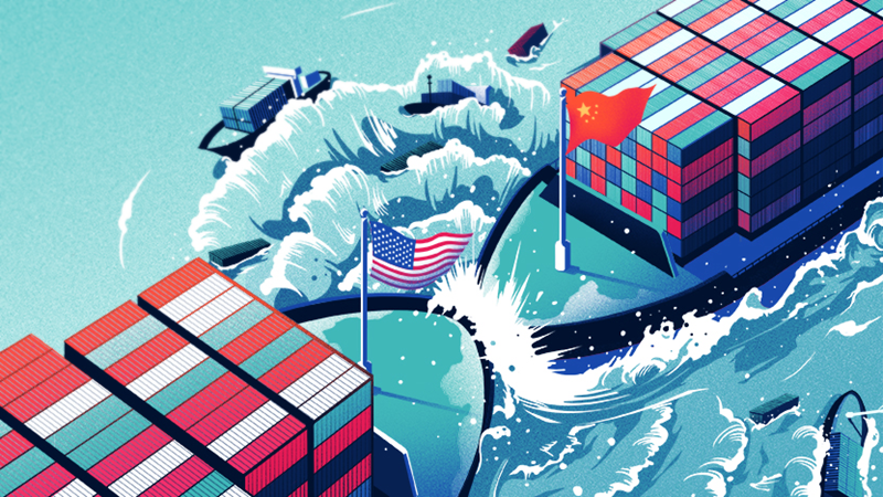
Bước thứ nhất: Chiến tranh thương mại
Từ tháng 3/2018, Tổng thống Mỹ D.Trump đã công bố kế hoạch áp thuế quan đối với hàng hóa đến từ Trung Quốc (TQ) vào Mỹ, lên đến 60 tỷ USD mỗi năm. Mục đích nhằm chống lại sự mất cân bằng thương mại giữa hai nước. Cho đến nay, Mỹ đã đánh thuế 10%, 25% cho hơn 6000 mặt hàng của TQ xuất khẩu vào Mỹ, với số tiền đánh thuế lên đến 250 tỷ USD. Đáp lại, TQ cũng đã đánh thuế 5.000 mặt hàng của Mỹ xuất khẩu vào TQ, với trị giá 110 tỷ USD. Như vậy, Mỹ đã đánh thuế gần 50% hàng hóa TQ xuất khẩu vào Mỹ. Còn TQ đã đánh thuế đến 85% số lượng hàng hóa Mỹ xuất khẩu vào TQ. Quả bóng đang ở sân phía TQ. Nếu TQ không tìm ra những giải pháp căn cơ, e rằng Mỹ sẽ tiếp tục cuộc chiến tranh thương mại với TQ.

Bước thứ hai: Chiến tranh công nghệ
Để chứng tỏ sẽ giữ lời hứa khi ra tranh cử, đó là kiềm chế sự trỗi dậy của ngành công nghiệp TQ, việc làm đầu tiên của Tổng thống D.Trump là ra những đòn “tấn công phẫu thuật, thông qua việc tăng thuế đối với các mặt hàng được nhắm đến trong kế hoạch “Made in China 2025”. Danh sách thứ nhất gồm 818 mặt hàng, trị giá 34 tỷ USD nhập khẩu, phải chịu thêm một khoản phụ phí 25% kể từ ngày 6/7/2018. Danh sách thứ hai gồm 284 mặt hàng, với mức tăng thuế chưa được quyết định. Trong danh sách này, không có các mặt hàng tiêu dùng.
Đối với các mặt hàng công nghệ, mục tiêu của Mỹ còn đi xa hơn nhiều so với một biện pháp trừng phạt . Đó là hạn chế những bước tiến của TQ bằng cách ngăn chặn hoạt động chuyển giao công nghệ cho nước này. Thị trường TQ luôn là nơi được mơ ước vì mang lại nhiều lợi nhuận và Bắc Kinh cho phép doanh nghiệp nước ngoài tiếp cận với yêu cầu phải nhượng lại công nghệ. Từ khi Tổng thống Trump lên nắm quyền, ông kiên quyết thực hiện chính sách chống lại việc TQ vi phạm, thâu tóm, mua bán bản quyền công nghệ, đặc biệt là công nghệ cao của Mỹ. Vì vậy, hai năm qua, các doanh nghiệp Mỹ đã do dự hơn khi quyết định làm ăn với TQ. Còn phía doanh nghiệp TQ, họ đầu tư ra nước ngoài nhằm mục tiêu tiếp cận nguồn tài nguyên và công nghệ cao của thế giới, trong đó có Mỹ. Từ năm 2014-2016, các doanh nghiệp TQ đã đầu tư vào Mỹ nhiều hơn các doanh nghiệp Mỹ đầu tư vào TQ, kéo theo đó là việc TQ tiến hành các hoạt động gián điệp nhằm ăn cắp công nghệ cao. Vì vậy, Mỹ là nước đầu tiên ở phương Tây thực hiện cuộc tấn công mạnh mẽ vào kế hoạch “Made in China 2025”.
Bước thứ ba: chiến tranh trong lĩnh vực tiền tệ, tài chính
Ngay trong tuyên ngôn tranh cử Tổng thống Mỹ (năm 2016), ông D.Trump đã đặc biệt phê phán chính sách “thao túng tiền tệ” của Trung Quốc, ông nói “Trung Quốc đưa đến ba mối đe dọa lớn đối với Mỹ khi thao túng tiền tệ quá đáng…với mục đích đẩy mạnh xuất khẩu của họ và hủy hoại các ngành công nghiệp của Mỹ. Với việc thao túng đồng Nhân dân tệ và định giá thấp nó, Trung Quốc có thể bán hàng cho các nước khác với giá thấp hơn rất, rất nhiều so với một công ty Mỹ”. Vì vậy, “trọng trách của ông D.Trump là phải “chấm dứt trò thao túng tiền tệ ” của Trung Quốc.
Rất có thể Mỹ sẽ có cuộc chiến tranh về tỷ giá, tiền tệ, tài chính với Trung Quốc. Nếu điều đó xảy ra, kịch bản về một cuộc khủng hoảng kinh tế sâu sắc đối với Trung Quốc là hoàn toàn có thể. Bởi vì hệ lụy của một cuộc chiến tranh về tiền tệ, tài chính sẽ rất lớn.
Bước thứ tư: Chiến tranh kinh tế toàn bộ
Sau khi tiến hành các cuộc chiến tranh thương mại, công nghệ, tỷ giá tiền tệ, Mỹ sẽ phát động cuộc chiến tranh thứ tư, tiến hành “chiến tranh tổng lực” chống lại toàn bộ nền kinh tế của Trung Quốc qua hơn 40 năm tiến hành cải cách mở cửa, tất cả các lĩnh vực kinh tế, chính trị của họ đều dựa vào Mỹ, nhưng với sự khôn khéo, Trung Quốc đã làm giàu “trên lưng” nước Mỹ.
Hậu quả của một cuộc chiến tranh thương mại đã khiến nền kinh tế Trung Quốc nam 2018 bị sụt giảm nghiêm trọng. Tăng trưởng kinh tế Trung Quốc năm 2018 thấp nhất gần 30 năm qua, chỉ đạt mức 6,6% GDP. Mức nợ công lên đến 28.000 tỷ USD. Đầu tư không hiệu quả, sản xuất dư thừa, hàng hóa tồn đọng, không tiêu thụ được. Các nhà đầu tư nước ngoài ở Trung Quốc đã chuyển ra các nước láng giềng xung quanh Trung Quốc. Tình trạng thâm hụt ngân sách lớn, tỷ lệ thất nghiệp gia tăng. Kinh tế Trung Quốc đang có dấu hiệu “hạ cánh cứng”. Dự báo năm 2019, tăng trưởng kinh tế Trung Quốc còn tiếp tục bị suy giảm.
Sự suy giảm kinh tế do hệ lụy của cuộc chiến tranh kinh tế với Mỹ đã buộc Trung Quốc phải thay đổi mô hình tăng trưởng, chấp nhận tăng trưởng để “hạ cánh mềm”, tăng trưởng bền vững, chuyển từ đầu tư lớn, xuất khẩu nhiều sang giảm đầu tư, đẩy mạnh tiều dùng trong nước, phải thay đổi về chất… Đó là cách lựa chọn duy nhất của Trung Quốc trong giai đoạn mới hiện nay.
Bằng việc khởi động một cuộc chiến tranh kinh tế mang tên “làm cho nước Mỹ vĩ đại trở lại”, Tổng thống D.Trump đã phá vỡ cấu trúc của trật tự thế giới mà Mỹ đã xây dựng từ cuối Chiến tranh Thế giới thứ hai, và thay thế bằng một trật tự mới, mà ở đó Mỹ, cũng giống như ước Anh thế kỷ XIX, sẽ không có đồng minh hay kẻ thù vĩnh viễn, mà chỉ có những lợi ích là trên hết. Và cuộc chiến tranh kinh tế Mỹ – trung liệu có kéo dài đến 20 năm như dự báo của ông Jack Ma, chủ tịch Tập đoàn Alibaba hay không? Điều đó có lẽ còn phải trông chờ vào sự “xuống thang” của Trung Quốc, và những kế hoạch giáng trả tiếp theo của Mỹ. Mọi diễn biến vẫn ở thế hi vọng./.
![]()
Views: 0
The sovereignty dispute over the Paracel Islands in the South China Sea between Vietnam and China has lasted for 45 years, which is one of the longest disputes between claimants over the same islands. This is also a complicated dispute without any legal or political solution so far, somehow more complicated with repeated tensions and settlements followed by growing flares up since the Chinese side attempts to change the status quo by deliberately changing the form of the islands, expanding long-term occupation in more and more waters in order to gain control of the trade flows in the South China Sea. At the same time, China deliberately seeks to take the Paracel Islands as a naval base for protecting its mainland from far away, or as a springboard to attack its neighboring countries.
After the Chinese navy took the Paracel Islands by force from the Republic of Vietnam in January 1974, the Government of the Democratic Republic of Vietnam (later the Socialist Republic of Vietnam), the legitimate successor of sovereignty over the Paracel Islands, has repeatedly presented evidence of Vietnam’s legitimate and lawful sovereignty; strongly protecting its national sovereignty and demanding China to return the islands to Vietnam. Vietnam has also adopted a series of peaceful measures in resolving disputes with China, including friendly meetings at all levels, discussions with China’s relevant agencies, sending correspondences and notes, organizing private and public meetings, sharing information with international public and the United Nations… Despite these measures, the Chinese side did not stop but rather make more provocative actions, encroaching on Vietnamese sovereignty, running against international conventions and ethics in relations with neighboring countries, which are showcased by the following noticeable actions:
On March 14, 1988, China put naval forces at war with Vietnam’s on-duty forces at six groups of islands and reefs in Spratly archipelago including Fiery Cross, Cuarteron, Gaven, Hughes/Hugh Reef, Johnson and Subi Reefs. With advantages of large army and vessels, China occupied these islands and reefs.

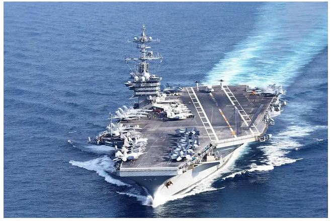
Photo: China’s first entirely home-built aircraft carrier began sea trials earlier this year (Source: Internet)
On February 25, 1992, China passed the Law on Territorial Sea of the People’s Republic of China, which not only asserted China’s claim to the Paracel and Spratly Islands but also reiterated its claims to almost the entire South China Sea, from Taiwan to James Shoal in Borneo’s offshore.
On May 8, 1992, China unreasonably allowed its partner, Crestone Company from the US, to conduct oil exploration in Vanguard Bank area within Vietnam’s continental shelf.
On May 15, 1996, China joined the 1982 United Nations Convention on the Law of the Sea and pledged to settle disputes “in accordance with recognized international law.” However, on the same day, China announced an ordinance to expand its territorial sea, which applied the baseline mapping of the archipelago nations to the Paracel Islands. This action was regarded by scholars in Southeast Asia as “inconsistent”, a topic for questioning at ASEAN meetings then.
On June 21, 2012, China blatantly declared the establishment of “Sansha city” with Woody Island as its capital, with the 9-dash line including Paracel and Spratly Islands as the administrative boundary. A city with an administrative size that accounts for 80% of the South China Sea is an unprecedented form of city in human history because it delineates millions of square kilometers of sea area into a “lake” in the city following the internal water regulation of a country, directly influencing not only the South China Sea countries but also the freedom of navigation, overflight and security of others.
On June 23, 2012, China Offshore Oil and Gas Corporation (CNOOC) issued an international bid notice for 9 oil and gas blocks located entirely within Vietnam’s exclusive economic zone and continental shelf, just 37 nautical miles off Phu Quy coast, a region that has never been in dispute with China.
On May 2, 2014, China installed the Haiyang Shiyou-981 oil rig in an area just 17 nautical miles off the south of Triton Island which is located within Vietnam’s 200 nautical mile exclusive economic zone to conduct oil and gas exploitation within Vietnam’s sovereign waters. The Vietnamese people had to spend more than two months on the sea to “kick” the rig out of Vietnam’s waters.
This is to brief blatant actions in daylight by China, acting as a big country to infringe upon the sovereignty of Vietnam and other the countries in the South China Sea, which were discovered, condemned and fought against by Vietnam. Countries in the region and the international community also observed and collectively protested these actions as irrational and illegal ones, forcing China to falter for some moments.
In addition, China also has many other tricks aimed at monopolizing control of South China Sea that are known to just a few. Without proper awareness, countries in the region with sovereignty disputes with China and even international legal and archaeological experts may be put in its traps one day, with the following actions that should be seriously noted by everyone:
Under a viewpoint and mindset that its nation’s maritime sovereignty includes both legal and historical evidences, China has always demanded international public opinion and law to consider historical factors in forming its sovereignty in the South China Sea. And to ensure that China has reliable historical evidence in the South China Sea for a long time, this evidence should appear in places where they need to. So Chinese unnumbered fishing vessels were ordered to sail offshore to silently drop Chinese ‘antique’ items that had been searched for, collected and excavated inland years ago, particularly those which are old, broken, no longer valuable but bearing the signs of previous Chinese feudal dynasties, into the waters claimed by China as “historic waters”. Then one day when a dispute breaks out, China will show countries that their “historical evidence” is already at the bottom of the sea, which will be hardly denied by these countries.
Secretly dropping ancient items into the sea sounds easy, the thing is to let them appear in other people’s land. So China opened up secret campaigns for “frogmen” to infiltrate the islands controlled by other claimants, dig and bury those items deeply under the ground. In case it is impossible to break in due to tight control, China can use money to buy locals to help them bury the items instead. Chinese fishing vessels and fishermen working at sea communicated and interacted with other countries’ fishermen and offshore fishing vessels, making them an ideal bridge to bury the “historical evidence” on targeted islands. This explained when the local governments and people took underground works on the islands that has never had any footprints of Chinese people, they were startled to find many Chinese “artifacts” under the ground without knowing when they were buried.
That’s not all but just one way to fabricate evidence for China’s sovereignty. Another way that few people know is to put carved sovereignty stones just under the disputed sites to China’s contenders’ surprises, which is done by Chinese professional divers. They secretly got onboard minisubs carrying necessary tools, quietly and secretly approaching foot of the atolls in the deep sea, checking and searching for flat coral cliffs, then drilling, sharpening, and carving into flat walls with Chinese emblem or Chinese ancient letters to “mark” its sovereignty. The true owners of those atolls can neither control the deep sea floor nor know right under their feet, they were “intruded by neighbor”.
Therefore, occasionally the Chinese media and authorities reported that they “happened” to find in this or that sea area within the ‘9-dash line’ in the South China Sea some Chinese antiques, which are excavated then noisily exhibited and communicated in order to draw the world’s attention, especially China’s “in-house” journalists and some ignorant archaeologists to come and see. These people who do not know the truth will easily accept and boast, “True! China probably has historic waters in that place.”
China’s actions in the South China Sea, both overtly and covertly, show that countries with territorial sovereignty disputes with China must be constantly vigilant to protect their lands, as people say, vigilance is never redundant. And as a Western politician who is very knowledgeable about Chinese culture and customs said, “When you shake hands with a Chinese, you have to check how many of your fingers remain”./.
![]()
Views: 0
In Chinese leaders’ eyes, the South China Sea is critical to their strategy of expanding China’s influence and making China a world power. Politically speaking, the South China Sea is where China can deploy its “soft border” doctrine and its “Look South” policy, a “vital” way for China to overcome surrounding countries such as India, Russia, Japan and Republic of Korea to expand its influence in the world, a “gateway” for China to get out of the US containment and restraint to become a world power. In economic terms, the South China Sea is abundant in natural resources which can be exploited to make an important contribution to the rapid economic development of the most populous country in the world that is falling into a serious shortage of natural resources, particularly oil. With one of the world’s busiest maritime and air routes through the South China Sea, so “who controls the South China Sea will control economic development in East Asia”. From the military angle, the South China Sea is the entry into the Asian continent for US and Japanese naval forces, which is the passage for warships from the Indian Ocean to the Pacific Ocean. The South China Sea is also home to many important islands with strategic and tactical significance at sea to keep traffics and other activities at sea in control. Islands in the area can be developed into military bases which can serve as a starting point to attack enemies as well as a belt at the frontline to defend the mainland from afar. Therefore, with control over the South China Sea, China will expand its defensive space, pushing the battlefield far away from China’s mainland. More military bases in the islands will allow China to monitor and possibly threaten military operations of Southeast Asian countries, including controlling the US military operations. In addition, controlling the South China Sea also helps China to gather strength of millions of Chinese in Southeast Asian countries, strengthening national cohesion, supporting the unification and recovery of Taiwanese territory.

Therefore, China for long has an ambition to “monopolize control of the South China Sea” through which to penetrate and dominate Southeast Asian countries in all areas of politics, economy, culture and military, thus expanding its role and influence in the Asia-Pacific region and the world. China strives to implement the “Blue Ocean” strategy with the main idea of “Open the door to the outside world, develop an outward-oriented economy in association with the right diplomatic and politic guidelines and a strong naval force to strongly support national development”. Accordingly, China sets the policy in the South China Sea to: Strengthen the defense potential, especially naval forces with capabilities to win and make deterrence at sea, a firm support for other activities to gradually take control of the South China Sea, ensuring China’s decisive role in the Asia-Pacific to become a world-class maritime power. China identifies the goal of step-by-step “reclaiming sovereignty” towards implementing “exclusive control” of the South China Sea to make way to the Pacific Ocean and facilitating access to the Indian Ocean, promoting China’s marine economic development and striving to make China a marine economic power, attaching special importance to exploiting oil and gas resources to meet domestic economic development demands, linking the “island chains” both as a boundary of self-defence and a boundary of operation. China identifies Japan – Taiwan – Hainan – Paracel Islands – Spratly Islands as the “inner island chain”, Japan – the Philippines – Kalimantan – Sri Lanka as the “outer island chain”, striving for its maritime force to be the active force in the “inner island chain” by 2010 and in the “outer island chain” area after 2010.
With this ambition in mind, China officially claims to the world that they have “sovereignty” over a large part of the South China Sea, which is delineated by a 9-dash line unilaterally drawn by China to occupy the waters of many countries in the South China Sea. China has developed and implemented a series of policies and steps to realize its ambition, with the following noticeable actions: The first is to constantly seek to legalize the claim of “sovereignty rights ” in the South China Sea; the second is to promote implementation of the “Marine Economic Development Strategy” to support the South China Sea strategy; the third is to promote implementation of oil and gas exploration and exploitation plans in the South China Sea; the forth is to strengthen the military power, with prioritized development of naval forces, air force and strategic missiles in order to control the South China Sea while preventing other countries’ interference; the fifth is to promote the policy of “setting aside disputes for joint exploitation” to divide ASEAN countries, prolonging time for the right opportunity for China to implement its strategic objectives in the South China Sea.
China’s policies and steps to implement “monopolizing control of the South China Sea” ambition in the past few decades have made the situation in the South China Sea constantly unstable. The South China Sea has become one of the hottest “hot spots” in Asia-Pacific. These policies and steps themselves lead to unexpected risks and challenges for China and its leaders, specifically:
Firstly, China’s ambition and actions have clearly revealed China’s “expansionist” ideology and ‘Great Han’ chauvinism, which have been deeply rooted for a long time from the ancient feudal China, bringing neighboring nations and people great losses and sufferings that will remind them of continued vigilance to defend their sovereignty, independence and autonomy. This is the ideology that leaders of the new socialist China took all efforts to deny and soften to build the image of a China with full responsibility, respect for legitimacy, fairness, equality and support to developing nations and peoples. Today no one believes that China and its leaders have abandoned the “expansionist” ideology, disabling China’s image improvement efforts so far.
Secondly, China’s ambitions and actions are not supported by all Chinese people who have knowledge, patriotism, respect for the right and national pride, not accepting what China is doing in the South China Sea. There have been many voices of protest in the country and critics of reputable Chinese scholars against unreasonable 9-dash line claim by the Chinese leader. That disagreement has caused serious debates among China’s social classes and partly undermined public trust in the country. Of course, Chinese leaders have to find ways to silence those opinions. However, this only leads to accumulation of latent public disagreement, which may be added by weaknesses in other areas of social life that have not been settled by the regime to make the Chinese society at risk of instability.
Thirdly, what China has done in the past few years has made themselves a direct contender with all claimants in the South China Sea. When China behaves as a big country, smaller and weaker countries must of course keep patience, even silence, to remain in peace. But that patience has its own limits since national sovereignty is very sacred and is also living space for the people of these countries. Threatened countries will be forced to build and increase military potential to ensure their defense of national sovereignty. It is natural that smaller and weaker countries will come together and support each other in the “battle” against an opponent with superior strength. They may also try to get along with other big country to get an “umbrella” in case of emergency, even joining an alliance or setting up a foreign military base in their own countries. Chinese leaders seem to have recognized this too. So they are “appeasing” these countries with China’s policy of “amity, sincerity, preferentiality, and inclusiveness“. But how to regain such amity and sincerity when its ambition remains intact?
Fourthly, for a long time, the Western media have strongly propagated the “China threat” theory with a lot of images and perspectives on a violent China, which will someday fight against other nations once it becomes a world superpower. The Chinese propaganda and communication apparatus had to operate at full capacity to rectify and reject it, arguing that it was the way the West scared people against China. Ironically, China’s ambition and actions in the South China Sea are the most specific, authentic and clear evidence of what China is doing as a threat to the world, firstly to Southeast Asian countries. It turns out what the West says is not an “exaggeration”.
Fifthly, China’s ambition and actions cannot come unnoticed by the US and Western powers. In the context of global geostrategic competition, China’s behaviors towards the South China Sea countries are unexpectedly creating opportunities for the US and the West to return to the Asia-Pacific in an open way to stop China’s “southward” pathway. The US knows what and where China’s grand strategy is, so the strategic focus to prevent China will be in the South China Sea. With the “America first” motto, the US will be willing to engage, including by military measures to protect the US citizens and “interests” in this waters. China will have to confront the US right in its “gateway.” In retrospect, has China any “allies” that are willing to join them in a “game” against the US and its powerful allies? Obviously, the “China Dream” of “the great renaissance of the Chinese nation” is hard to become true in the medium term.
The overview of five risks and challenges China will face in its ambition of “monopolizing control” of the South China Sea shows that it is not easy for China to achieve what it wants. The best way is to stop that ambition when it’s not too late./.
![]()
Views: 0
|
BA XU THẾ CẠNH TRANH CHIẾN LƯỢC BIỂN MỸ – TRUNG
Từ năm 2010, các chuyên gia Mỹ đã coi Trung Quốc (TQ) là đối thủ cạnh tranh chiến lược lớn nhất trên biển, bắt đầu có phản ứng về mặt chiến thuật, liên tục thúc đẩy các khái niệm tác chiến như “liên hiệp tiến vào và cơ động”, “tiến vào toàn khu vực”… Kể từ năm 2016 đến nay, Quân đội Mỹ đẩy nhanh việc chuyển đổi mô hình chiến lược trên biển, từ “biển tới đất liền” đến “trở về với biển”; từ tập trung chống khủng bố, bảo vệ an ninh trên biển chuyển sang cạnh tranh chiến lược trên biển với các nước lớn , trong đó không thể không nhắc đến TQ.
Hiện tại, cạnh tranh chiến lược trên biển giữa TQ và Mỹ cho thấy rõ 03 xu thế:
Một là, cạnh tranh chiến lược ngày càng gia tăng. Sự tin tưởng nhau về chiến lược trên biển giữa Mỹ và TQ ngày càng bị thu hẹp, sự hợp tác bị cản trở, ý thức cạnh tranh nhanh chóng tăng lên. Trong bối cảnh Mỹ ngày càng gây sức ép, mâu thuẫn và đối đầu Mỹ – Trung tại các điểm nóng như Biển Đông hay đảo Đài Loan chưa có dấu hiệu lắng xuống.
Hai là, phạm vi cạnh tranh mở rộng, tính chiến lược ngày càng mạnh. Đối với Mỹ, phạm vi của mối đe dọa trên biển từ TQ đã được mở rộng, tính chất được chiến lược hóa cao độ. Cạnh tranh quân sự Mỹ – Trung trước đây chủ yếu tập trung vào các lĩnh vực cục bộ và các vấn đề cụ thể, nhân tố tiêu cực trong quan hệ quân sự hai nước vẫn chưa tăng đến mức ảnh hưởng đến toàn cục.
Hiện nay, Mỹ rất nhạy cảm với các hoạt động mở rộng ảnh hưởng của TQ trên biển nên cạnh tranh chiến lược vốn có giữa hai cường quốc lớn nhất thế giới này trở nên trầm trọng hơn, không còn giới hạn ở vùng biển Đông Á. Đồng thời, không chỉ là cuộc đọ sức về thực lực quân sự mà còn liên quan đến cuộc đấu toàn diện về chiến lược, trật tự khu vực và quy tắc quốc tế.
Ba là, ngày càng nhiều nhận định về khả năng xảy ra va chạm và xung đột quy mô nhỏ. Cạnh tranh chiến lược trên biển giữa Mỹ – Trung không giống với cạnh tranh chiến lược trên biển giữa các nước lớn trong lịch sử. Cạnh tranh chiến lược Mỹ – Trung sẽ là một sự giằng co và tiêu hao chiến lược lâu dài. Tuy nhiên, không giống với sự đối đầu của Mỹ – Liên Xô men theo bức tường Berlin trước đây, cạnh tranh chiến lược trên biển giữa TQ và Mỹ có “vùng xám” rộng hơn. Điều này sẽ giảm bớt mức độ đối kháng nhưng đồng thời cũng khiến cạnh tranh càng trở nên khó quản lý hơn, càng nhiều khả năng xảy ra xung đột vũ trang quy mô nhỏ.
LIỆU MỸ – TRUNG CÓ THỂ CHUNNG SỐNG HÒA BÌNH TRÊN BIỂN?
Trong bối cảnh này, đấu tranh và xung đột lâu dài là điều khó tránh khỏi. Trước khi đạt được thỏa thuận thực sự, hai cường quốc lớn nhất thế giới cần phải tính đến cách thức làm thế nào để vượt qua giai đoạn rủi ro cai trong 10-20 năm tới. Đây chắc chắn là vấn đề lớn không chỉ cho hai nước Mỹ – Trung mà còn cho cả thế giới.
Riêng trên biển, hai bên có nhiều khả năng hình thành thế lực ngang nhau tại một số khu vực ở Tây Thái Bình Dương. Do đó, cạnh tranh chiến lược Mỹ – Trung trên biển có thể sẽ mang sắc thái tranh đấu quyền lợi rất mạnh mẽ. Để tránh xảy ra tình hình xấu nhất, quân đội hai nước Mỹ – Trung cần phải tăng cường xây dựng năng lực kiểm soát khủng hoảng nhưng quan trọng hơn là phải chuẩn bị thỏa hiệp và hợp tác trên một loạt vấn
đề quan trọng.
Trước tiên, cần phải đạt được nhận thức chình cần thiết về cơ cấu quyền lực trên biển Tây Thái Bình Dương. Tại vùng biển này, Mỹ – Trung nhất định phải thích ứng được với cơ cấu quyền lực tương đối cân bằng được tạo dựng bởi tỷ lệ sức mạnh mới.
Đồng thời hiểu rõ mặt yếu và khuyết điểm của mình, sử dụng một cách thận trọng sức mạnh và khả năng kiềm chế các hành động gây kích động, học cách chung sống hòa bình. Hai nước cần tiến hành đối thoại về khu vực Tây Thái Bình Dương càng sớm càng tốt.
Hai bên có thể tham vấn, trao đổi về ý tưởng chiến lược, tiến hành đối thoại về kiểm soát quân sự, thậm chí là hạn chế lẫn nhau liên quan đến sự phát triển vũ khí quân sự trên biển. Qua đó tạo ra sự đồng thuận cần thiết về việc phân phối quyền lực tại khu vực này.
Trong việc xử lý vấn đề có sự tham gia của nhân tố bên thứ ba, cả hai bên cần phải lý trí, tránh suy diễn. Nếu Mỹ thực sự mong muốn cùng với TQ tiến hành đối thoại chiến lược, và chính sách về vấn đề biển bao gồm cả Biển Đông thì cần phải kiềm chế và “hạ giọng” trong vấn đề chủ quyền để tạo được bầu không khí đối thoại. Trong quá trình đàm phán, TQ cần bình tĩnh hơn, không nên coi bất cứ hành động nào từ bên thứ ba đều bắt nguồn từ nhân tố Mỹ, từ đó có những phản ứng thái quá.
Cuối cùng, hai bên có thể cùng nhau tạo dựng quy tắc biển và trật tự khu vực mang tính bao dung. Bởi vì TQ và Mỹ trong tương lai đều khó mà xây dựng hoặc duy trì quyền lực chủ đạo tại khu vực này. Do đó, quy tắc hoặc trật tự trên biển của khu vực châu Á – Thái Bình Dương cần phải có sự đồng thuận của cả hai nước.
Điều này cần phải được xây dựng một cách có ý thức trong sự tương tác trên biển lâu dài giữa TQ và Mỹ. Hai bên đểu cần phải từ bỏ ý đồ và kế hoạch xây dựng cơ chế an ninh trên biển nhắn vào đối phương tại Tây Thái Bình Dương , thậm chí là Ấn Độ – Thái Bình Dương.
Cùng với các sự kiện đụng độ tàu thuyền và máy bay giữa TQ và Mỹ nhanh chóng gia tăng, hai bên cũng cần phải đưa ra quy phạm về hành động quân sự, cùng chung sống tại khu vực này./.
|
|
|
![]()
Views: 0
China’s ambition to “monopolize control” of the South China Sea is not only having command over the waters adjacent to Vietnam, the Philippines, Malaysia… in the South China Sea but also controlling waters thousands of kilometers away from China such as those close to Indonesia’s Natuna Islands. Although Indonesia has been vigilant, reacting fiercely and striving to protect its territorial sovereignty, it seems that their measures are not strong enough to stop China’s ambition.

(Location of Natuna islands)
The Natuna Islands, which belongs to Riau Province of Indonesia, consists of 272 large and small islands, located in the South China Sea, between the Malay Peninsula and the Borneo Peninsula and surrounded by a vast sea area with the population of more than 100,000. The archipelago has a wide range of resources such as marine produces, seafood, oil and gas reserves, and diverse ecosystems. The Natuna Islands stand in an important maritime route through the South China Sea, which connects the Strait of Malacca with the Java Sea. This is a lifeline route connecting the Pacific Ocean with the Indian Ocean; Europe, the Middle East and Africa with Asia, South Asia and Southeast Asia. Over a quarter of the world’s goods are shipped via this route. It is also a critically strategic trade route of Northeast Asian economies such as China, Taiwan, Japan and South Korea. Besides, the Natuna Islands are considered a special strategic location in monitoring activities in the South China Sea, including military and maritime security activities
In theory, the waters around the Natuna Islands in the southern part of the Malacca Strait have nothing to do with the territorial waters that China claims sovereignty over, because it is too far away from Chinese territory, over a thousand kilometers. According to the United Nations Convention on the Law of the Sea, it is three times further than the distance that China can claim. But the problem here is that China issued the statement on a “9-dash line”, the tip of which overlaps with Indonesia’s exclusive economic zone (EEZ) in the waters of the Natuna Islands. Beijing did not clarify its position on Indonesia’s exclusive economic zone in that area. Therefore, the exclusive economic zone that Indonesia claims currently has a no-small area overlapping with the waters within the “9-dash line” that China deliberately draws to claim its sovereignty in the South China Sea. According to China’s explanation, this sea area is both a historic area with the “Maritime Silk Road” established by Chinese many centuries ago, and a long-standing “traditional fishing grounds” of this country’s fishermen. On that basis, China began to eye and encroach this sea of Indonesia.
It must be said that, from a strategic angle, generations of the Chinese leadership have targeted Southeast Asia and its surrounding waters, and planned to gain control over this area for a long time. Mao Zedong’s statement that “I will lead 500 million Chinese farmers to march south” after the establishment of the People’s Republic of China was very typical of the Chinese leaders’ intention to control Southeast Asia. Accordingly, the Islands of Natuna and its surrounding waters in the South of the South China Sea are also located in the South China Sea. Having control over the entire South China Sea could help China quickly increase the number of commercial goods shipped, reducing the costs and ensuring more safety than using other routes. On the way for China to become a world power, the South China Sea maritime route from the Natuna Islands to the Malacca Strait will be vital to the Chinese economy, and therefore, it needs to manage this route itself to strengthen national security and expand its existence space.
Therefore, on the one hand, China insists on its long-time stance on the irrational “9-dash line” and throws allegations and fabricated documents on historical “evidence” for the so-called “traditional fishing grounds”. On the other hand, it has promoted field activities at sea, such as sending fishing vessels into the Natuna waters to exploit seafood, forcing Indonesia to react, turning “non-disputed waters into disputed waters” to gain public support. However, China’s desire has not been supported by countries in the region. In November 2015, after Indonesia announced that it could sue China to the International Criminal Court if the dispute in the Natuna Islands could not be solved by dialogue, China stated that it has no objection to Indonesia’s sovereignty over the Natuna Islands. But in return, Indonesia must reaffirm that it has no territorial claim to the Spratly Islands in the South China Sea, which is called Nansha Islands by China. They hoped this way would help put Indonesia out of the sovereignty disputes in the Spratly Islands, leaving the strongest claimant Vietnam alone, allowing China to break the bundle of sticks one by one.
Although China publicly acknowledged Indonesia’s sovereignty over the Natuna Islands in the South China Sea and that “it had no problem to be solved with Jakarta”, it also said that this was not applied to Natuna’s exclusive economic zone. One of China’s major strategies is to gain control over the arteries of global trade, especially the maritime routes in the South China Sea, in order to increase its power. Therefore, along with the continuation of the declaration of the “9-dash line” and the disputes over the seas and islands with Vietnam and the Philippines, etc., China keeps on using the concept of “historical sovereignty” and “traditional fishing grounds” to justify the violations by its fishing boats, maritime surveillance and coast guard vessels in the Natuna waters. Since early 2016, China has made a series of violations into the exclusive economic zone of the Natuna Islands, i.e. collisions between Chinese and Indonesian vessels, diplomatic and legal disputes and statements relating to Indonesia’s maritime sovereignty. Typically, on June 17, 2016, the Indonesian Navy was forced to fire a warning against 12 Chinese fishing vessels operating in the waters off the Natuna Islands, arrested the fishing boat Yu 19038 and 7 crew members. Immediately, the Chinese Ministry of Foreign Affairs vehemently protested, arguing that Indonesia’s maritime forces used force to injure Chinese crew members, and asserting that Chinese fishing vessels have the right of free fishing in “Chinese traditional fishing grounds”. Chinese Foreign Ministry spokesperson Hua Chunying said: “China and Indonesia have overlapping claims on maritime rights and interests.” To protect this position, on June 24, 2016, Chinese Navy sent the No. 409 Fleet (including attack submarines, guided-missile destroyers and rescue ships) to the Banda Aceh Sea, in the North of the Natuna Islands, to observe and protect its fishing vessels. Public opinion in Indonesia and other countries in the region had to consider this as a new Chinese move to increase pressure on Indonesia while the two countries often had “collisions” around the Natuna Islands.
It could be said that China’ continuous ambiguous messages on the limits of sovereignty over the Natuna Islands as well as its ‘salami slicing’ tactic by actively creating small collisions and slowly intervening to avoid strong reactions from the opponents, thus leading to a strategic change on the field, have made Indonesia somehow confused. So far, the Indonesian Government has always been lack of initiative in dealing with and proposing appropriate solutions to maritime sovereignty issues, including the control of the exclusive economic zone of the Natuna Islands. There are also different views within the Indonesian government itself on choosing between economic and political interests in its relations with China. Beijing clearly understands this and is taking active advantage of Jakarta’s weakness to gradually take the upper hand in turning Indonesia’s legitimate EEZ and continental shelf from a non-dispute area into a disputed zone with China.
On this, experts from the Indonesia’s Centre for Strategic and International Studies noted: “As the right time arrives, the notion of historical sovereignty plus a prepared reservation of some provisions of the 1982 UNCLOS will help China make new statements to legitimize the so-called 9-dash line and as such, a no-small portion of the Natuna Islands falls into Chinese territory as a matter of fact.” The commander of the Western Fleet of the Indonesian Navy, Rear Admiral A. Taufiq, pointed out: “When a country claims sovereignty over a territory, it must be present there. The Chinese way is to deploy fishing boats to the Natuna Islands in the form of illegal fishing, creating real-scene evidences to claim sovereignty in the South China Sea”.
Thus, by its ambiguous attitude in the recognition of Indonesian sovereignty over the Natuna Sea, combined with the regular penetration of fishing boats, maritime surveillance and coast guard vessels in the territorial waters of Indonesia, turning a non-disputed sea into a disputed one, progressively claiming sovereignty over the Natuna Islands, China has been taking steps to realize “total sovereignty” over the South China Sea, notwithstanding the waters belongs any Southeast Asia countries. In this situation should Southeast Asian countries ride a lone horse in the fight with China for sovereignty over islands and waters?
![]()
Views: 0
![]()
Views: 0
![]()
Views: 0


![]()
Views: 0
An exhibition was opened in the northern city of Hai Phong on April 8, giving visitors an insight into historical and legal evidence proving Vietnam’s sovereignty over Hoang Sa (Paracel) and Truong Sa (Spratly) archipelagos.
The exhibition, held at Ngo Quyen High School, showcases more than 80 maps, documents and photos testifying to Vietnam’s sovereignty over the two archipelagos. It also features video clips presenting the system of this historical and legal evidence.

Visitors to the exhibition at Ngo Quyen High School in Hai Phong city (Photo: VNA)
At the opening ceremony, Director of the Hai Phong Department of Information and Communications Luong Hai Au said seas and islands are a sacred and inseparable part of Vietnam throughout history. This exhibition is an important dissemination activity, helping to improve the public’s access to historical and legal evidence proving the country’s undeniable sovereignty over Hoang Sa and Truong Sa, Au said.
These proofs once again affirm that Vietnamese people have practiced their sovereign right over the archipelagos for a long time, he said, adding that they also refute some countries’ distorting arguments and groundless sovereignty claims to Hoang Sa, Truong Sa and other areas of Vietnam in the East Sea.
The official added the display also looks to improve public awareness, especially among students, of the safeguarding of the Fatherland’s maritime sovereignty; enhance people’s trust in the evidence of Vietnam’s sovereignty over Hoang Sa and Truong Sa; and encourage joint efforts to protest against wrong information and hostile viewpoints about the country’s maritime sovereignty.
The exhibition is scheduled to last through April 10.-VNA
![]()
Views: 0
Vietnam has once again demanded that China respect its sovereignty over Hoang Sa (Paracel) and Truong Sa (Spratly) archipelagoes in response to China’s live-fire drills and construction plan in Hoang Sa.
Foreign Ministry Spokeswoman Le Thi Thu Hang made the statement on March 28 at one of the ministry’s regular press conferences.

Foreign Ministry Spokeswoman Le Thi Thu Hang (Photo: VNA)
She reiterated that “Vietnam has sufficient legal foundation and historical evidence testifying to its sovereignty over Hoang Sa and Truong Sa archipelagoes in accordance with international law.”
China’s conducting of live-fire drills in Hoang Sa from March 22-24 and its plans to build the islands of Phu Lam, Cay, and Duy Mong in the Vietnamese archipelago into cities and strategic logistics service bases has “seriously violated Vietnam’s sovereignty over this archipelago; run counter to the agreement on basic principles guiding the settlement of sea-related issues between Vietnam and China; violated the spirit of the Declaration on the Conduct of Parties in the East Sea (DOC); complicated the situation in a way that is unfavourable for the current negotiations between China and ASEAN on a Code of Conduct of Parties in the East Sea (COC) as well as the maintenance of a peaceful, stable, and cooperative environment in the East Sea,” Hang said.
“Vietnam demands that China stop and not repeat similar activities, respect Vietnam’s sovereignty over Hoang Sa and Truong Sa archipelagoes, respect the common perceptions reached by the two countries’ senior leaders as well as international law, and cease activities escalating tensions or complicating the situation in the region,” she emphasised.
Hang added that the Vietnamese Ministry of Foreign Affairs had handed over a diplomatic note opposing these activities by China.
At the conference, the spokeswoman was also asked about Vietnam’s comment on US President Donald Trump’s signing of a proclamation recognising the Golan Heights as Israeli territory.
She said: “Vietnam shares the deep concerns of the international community over the recent developments relating to the status of the Golan Heights. We call on the related parties to act in line with relevant resolutions of the United Nations, respect international law, and resolve disagreements via dialogue for the sake of sustainable peace in the Middle East and the world.” –VNA
![]()
Views: 0
The 11th ASEAN Regional Forum (ARF) Inter-Sessional Meeting on Maritime Security wrapped up in central Da Nang city on March 15.

The two-day event was co-chaired by Vietnam, Australia and the European Union. Over 80 officials and experts on maritime security and cooperation from 27 ARF members and relevant international organisations looked into the current maritime situation, activities of cooperation mechanisms, countries’ policies and measures, maritime safety, maritime environment, and sustainable development.
Discussing the regional maritime security situation, participants emphasised the importance of ensuring security, safety and freedom of navigation and aviation, along with adherence to and enforcement of international law, including the 1982 UN Convention on the Law of the Sea (UNCLOS), on seas in the region.
They voiced concerns about the continued complicated developments at sea, including unresolved disputes; the increase of trans-national crimes like piracy, drug trafficking, and human trafficking; overexploitation of natural resources; and environmental pollution.
Given that fact, participants shared the view that countries in the region need to continue enhancing cooperation to deal with challenges in an effective manner.
Many of them also expressed concerns about the recent developments in the East Sea, including unilateral actions and militarisation, which have seriously affected peace, stability, security, safety and freedom of navigation and aviation in the region, hindering a favourable environment for cooperation to address common challenges.
They highlighted the principles of respecting law; adhering to and seriously implementing international law, including the 1982 UNCLOS; exercising self-restraint and not taking actions that can complicate the situation; not militarising; settling disputes by peaceful means; fully and effectively carrying out the Declaration on the Conduct of Parties in the East Sea; and building a substantive and effective Code of Conduct (COC) in the waters that is in conformity with international law.
The meeting recognised efforts by regional mechanisms and many countries to strengthen cooperation in ensuring maritime security, including setting up direct communication channels among defence officials, conducting joint patrols, building and expanding information sharing mechanisms, building and improving capacity, and ASEAN-China negotiations on an efficient and effective COC.
The meeting was the third activity on maritime security held by Vietnam within the ARF’s framework since the beginning of 2019. Participants spoke highly of the Vietnamese delegation’s role and contributions to the event.
Its outcomes will be reported to the ARF Senior Officials’ Meeting slated for late May in Thailand.
Founded in 1994, the ARF aims to promote countries’ dialogue and cooperation in political-security issues, thus contributing to peace, stability and trust building in the region. It comprises 27 members, including the 10 ASEAN member states and 10 ASEAN dialogue partners.
Among the ARF’s working groups, Vietnam, Australia and the EU are co-chairing the one on maritime security for the 2018-2020 period.-VNA
![]()
Views: 0